 FB
FB IN
IN| GUATEMALA |
| GUATEMALA | Picture Description |
|---|---|
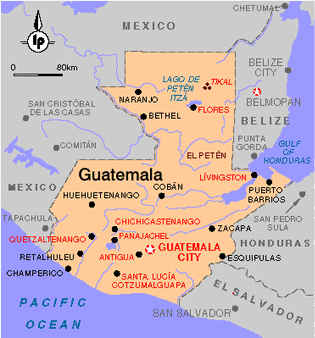 |
Map of Guatemala
A Spanish colony until independence in 1821. Population : 6,975,204 (July 2005) Median age: 19.15 years Fertility rate:3.87 children/woman (2005) Currency: Lempira (2004 18.2HNL=$1USD) GDP per capita: PPP $2,800 (2004) Population below poverty line: 53% Labor force - by occupation: Agriculture 34%, Industry 21%, Services 45% Honduras, one of the poorest countries in the Western Hemisphere with an extraordinarily unequal distribution of income and massive unemployment Source : CIA Factbook
|
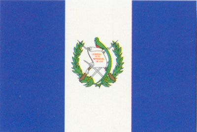 |
The National Flag of Guatemala
|
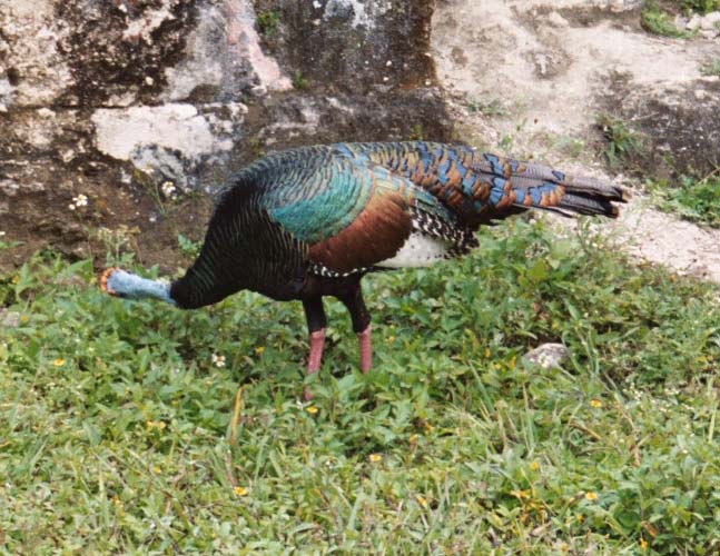 |
Bird
Location : Tikal (Mayan Ruins) Tikal is a UNESCO World Heritage Site. It is one of the largest Mayan Ruins that exist. |
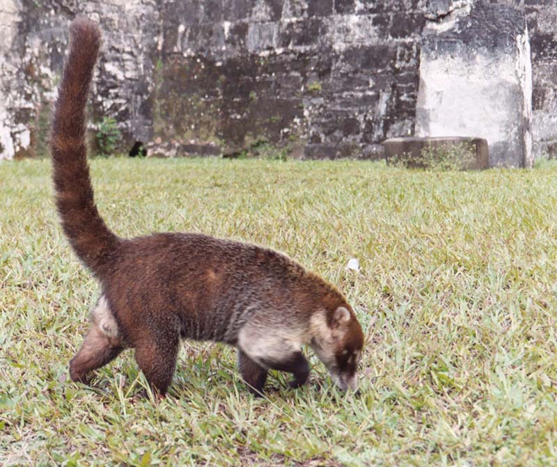 |
Lemur
Location : Tikal (Mayan Ruins) Mayan Ruins |
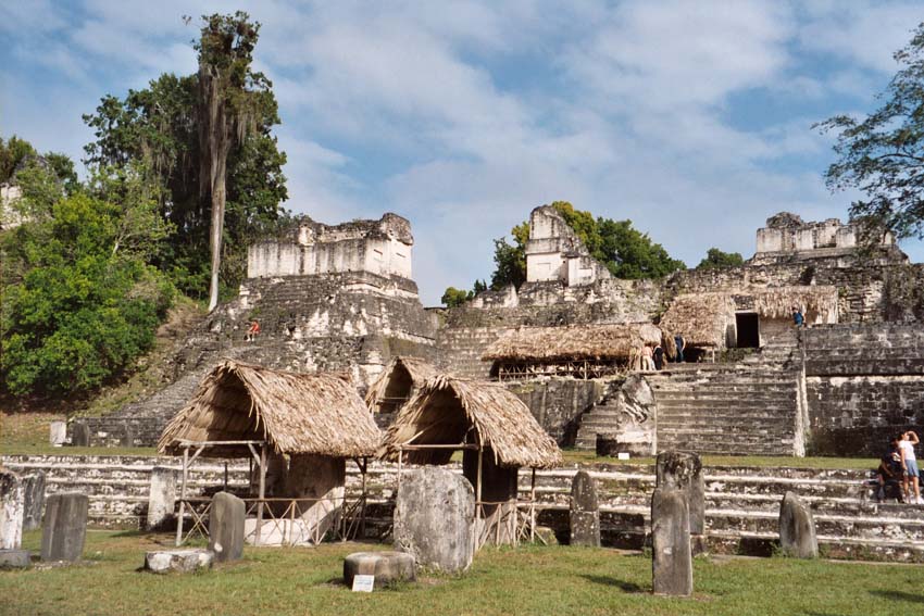 |
Central Plaza
Location : Tikal (Mayan Ruins) Mayan Ruins |
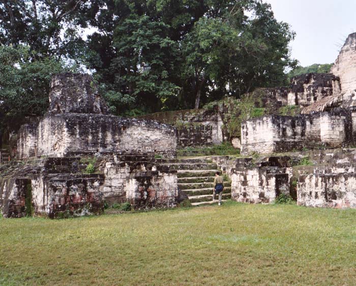 |
Plaza
Location : Tikal (Mayan Ruins) Mayan Ruins |
 |
Temple
Location : Tikal (Mayan Ruins) Mayan Ruins |
 |
Temple
Location : Tikal (Mayan Ruins) Mayan Ruins |
|
Plaza
Location : Tikal (Mayan Ruins) Mayan Ruins |
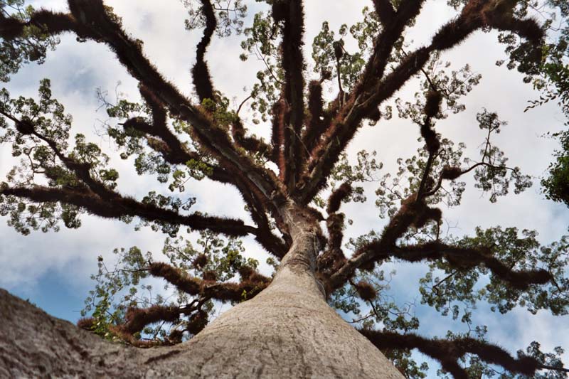 |
Ceibal Tree
Location : Tikal (Mayan Ruins) The Tree of Life |
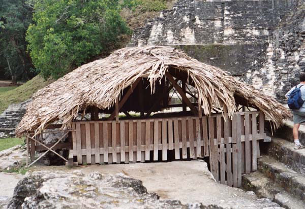 |
Hut
Location : Tikal (Mayan Ruins) Hut |
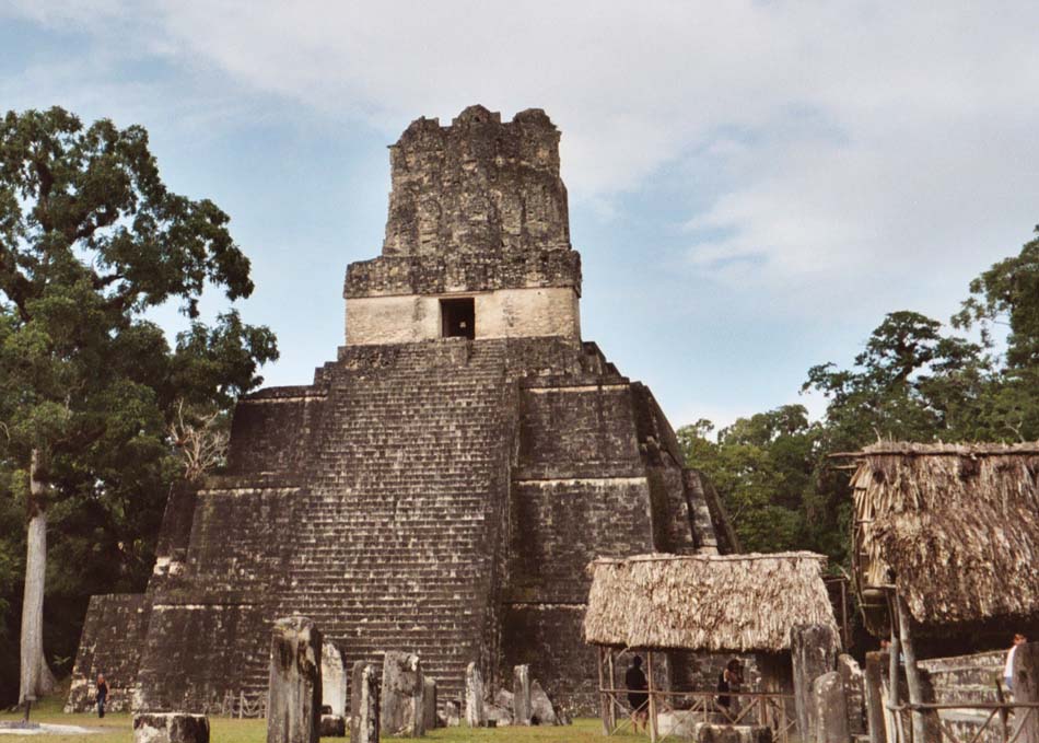 |
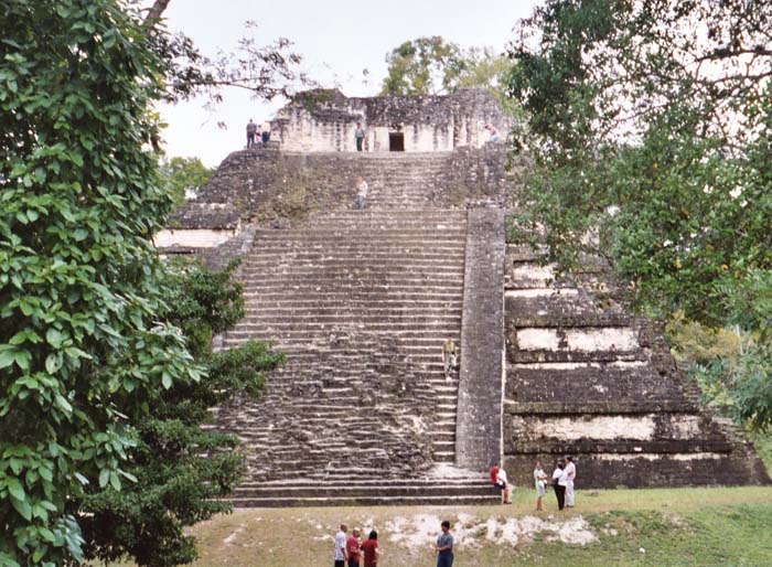
Templo 1
Location : Tikal (Mayan Ruins) Templo 1 (Temple 1), used together with facing temple for celestial calculations. The Mayan calandar was as accurate as the modern calendar. |
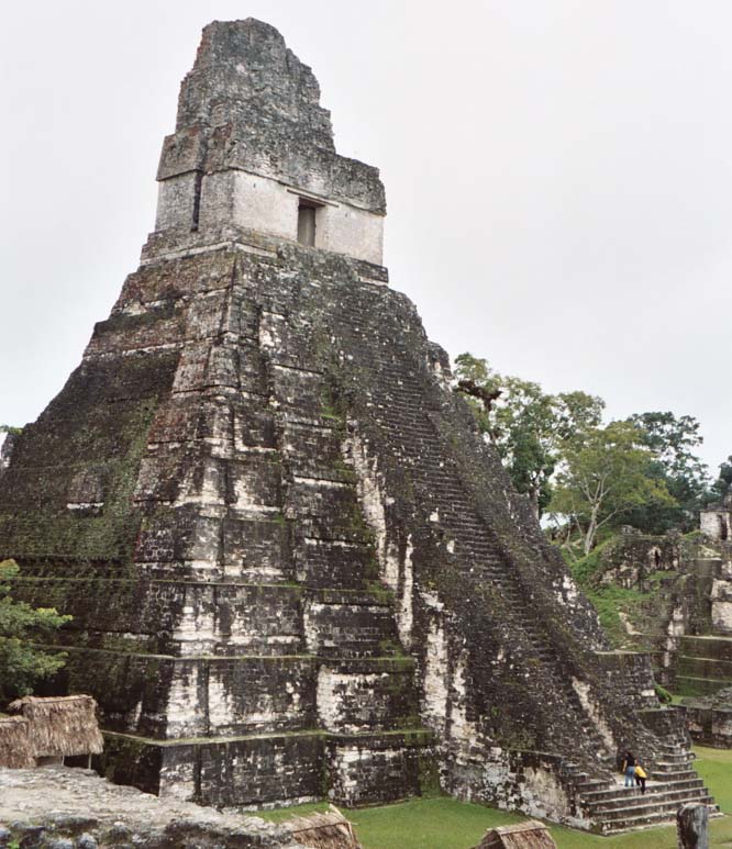 |
Templo 1
Location : Tikal (Mayan Ruins) Templo 1 facing temple |
 |
Templo 4
Location : Tikal (Mayan Ruins) View from Templo 4 |
 |
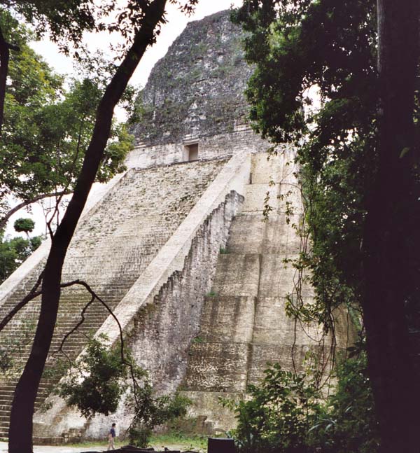
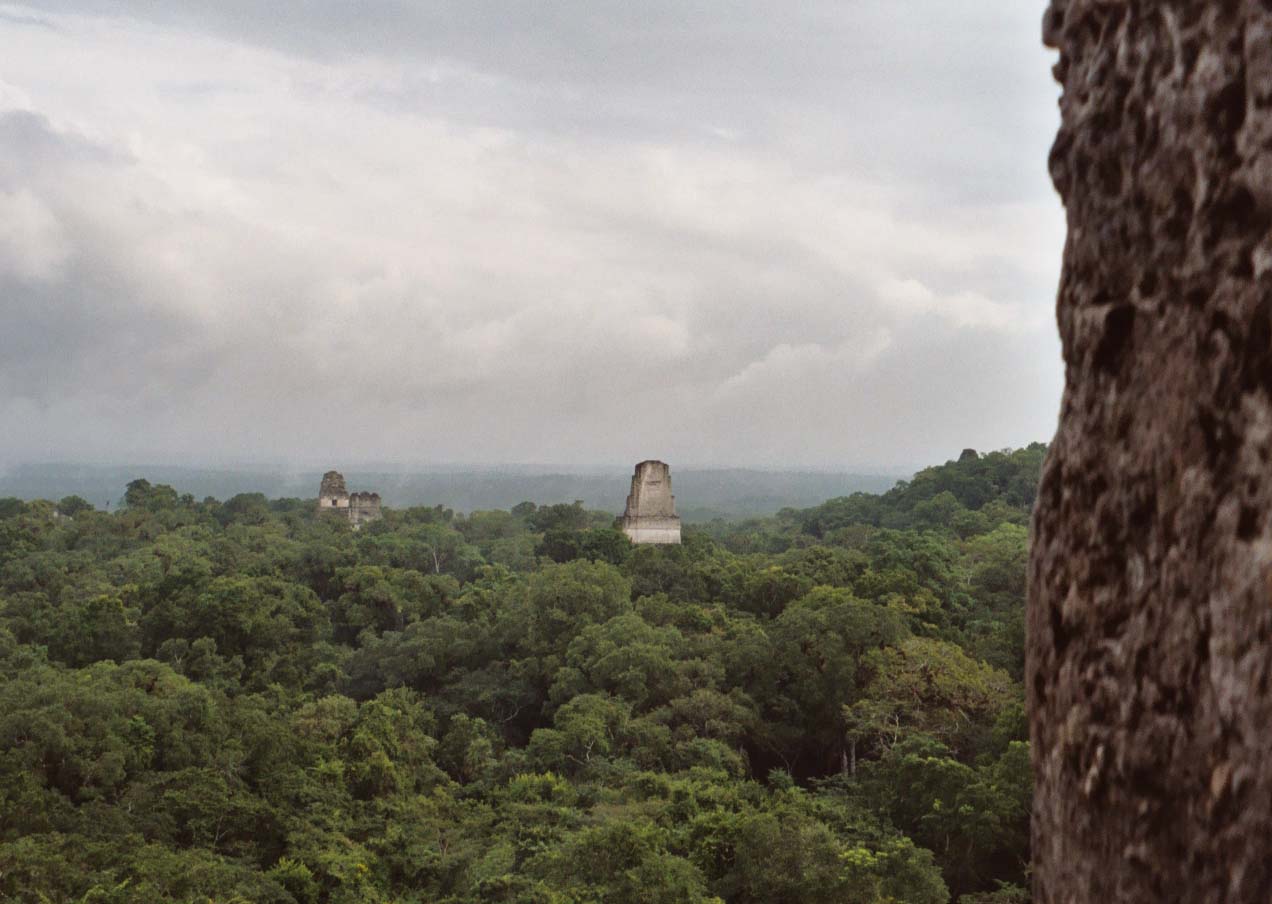
Templo 4
Location : Tikal (Mayan Ruins) View from Templo 4 rising 64 meters above the canopy jungle floor. You can see Templo 1 pair off in the distance. |
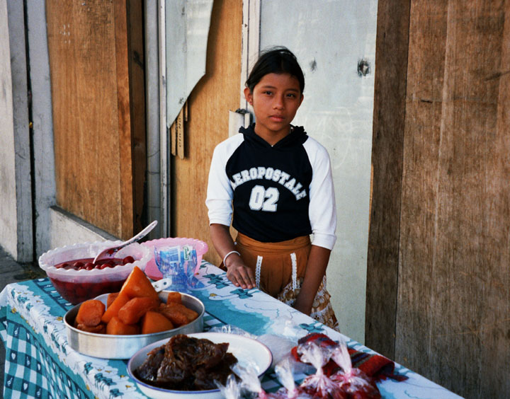 |
Antigua
Location : Antigua A Street Vendor, Antigua is a UNESCO World Heritage Site. |
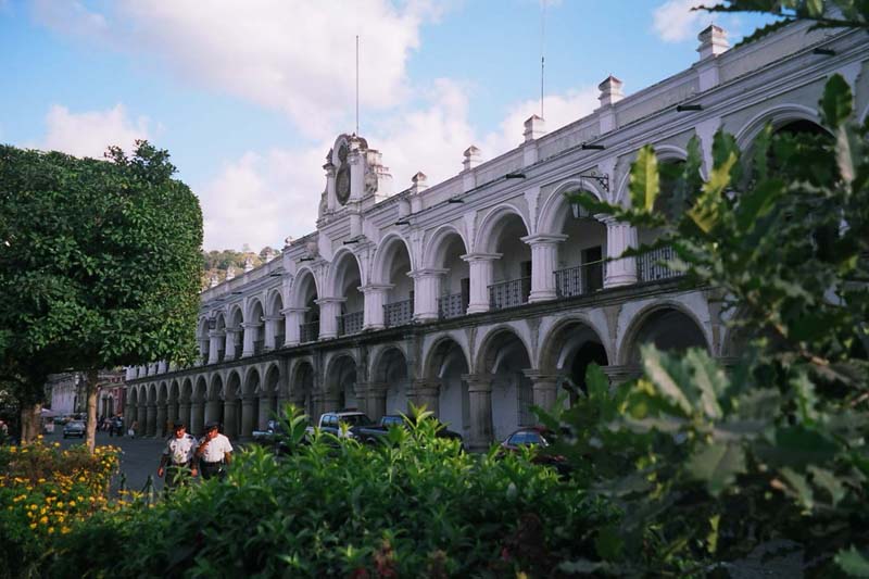 |
Antigua
Location : Antigua Palazio de'la Capitans is what makes Antigua famous, because it was the command and control center for all of latin america for 200 years from 1576 to 1776. |
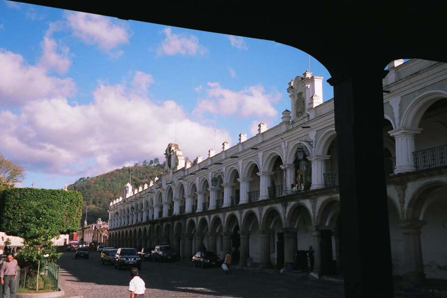 |
Antigua
Location : Antigua Palazio de'la Capitans |
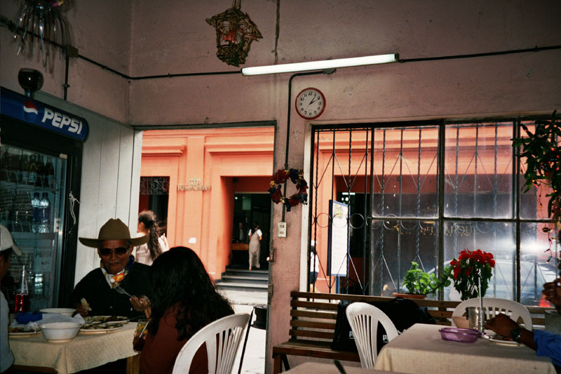 |
Antigua
Location : Antigua Restaurant Interior |
 |
Antigua
Location : Antigua A Volcano from the Central Plaza |
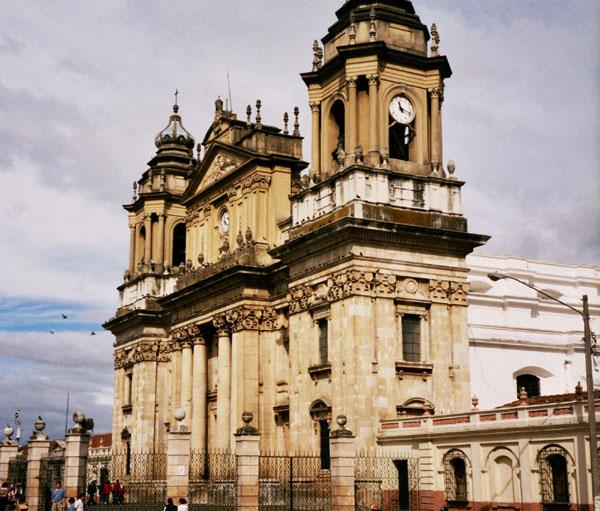 |
Antigua
Location : Antigua Church off the Central Plaza |
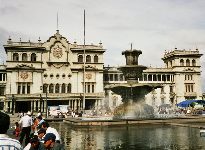 |
Antigua
Location : Antigua Central Government Building |
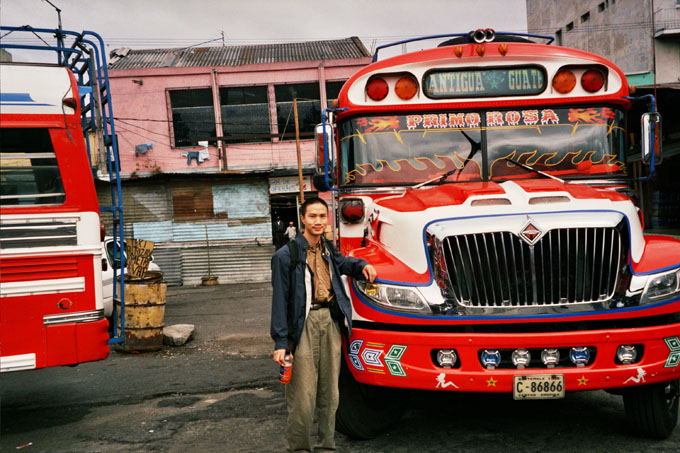 |
Antigua
Location : Antigua Chicken Buses used to travel around the country. Wildly painted old US school buses |
 |
Antigua
Location : Antigua Lunch |
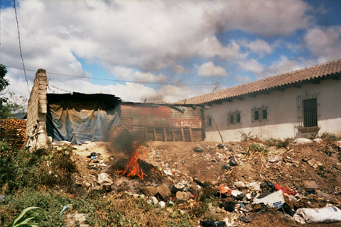 |
Antigua
Location : Antigua A cleansing garbage fire |
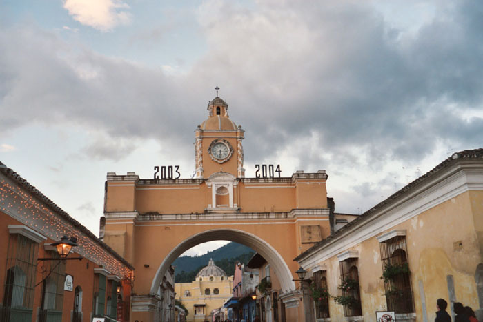 |
Antigua
Location : Antigua New Years from 2003 to 2004 |
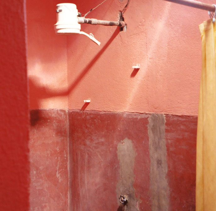 |
Antigua
Location : Antigua Typical Shower in Hotel |
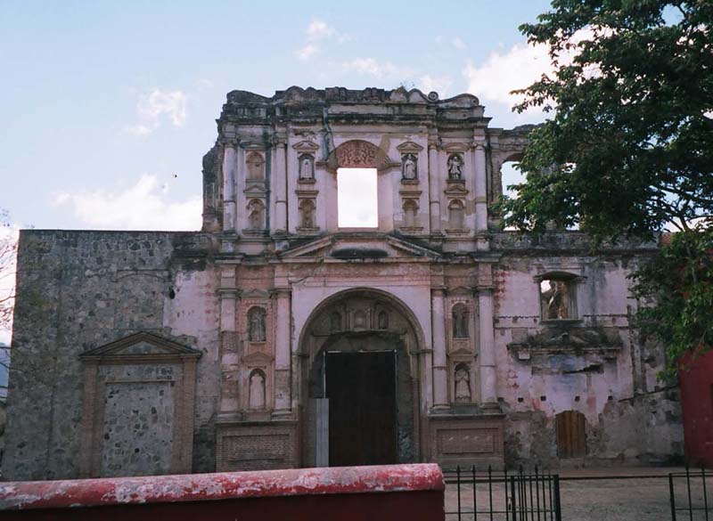 |
Antigua
Location : Antigua Old Church |
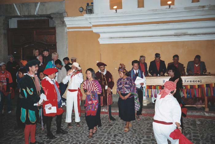 |
Antigua
Location : Antigua New Years Dance 12:01AM January 1 2004 |
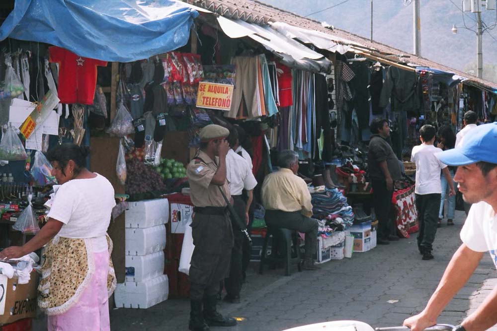 |
Antigua
Location : Antigua Outdoor Mall Security |
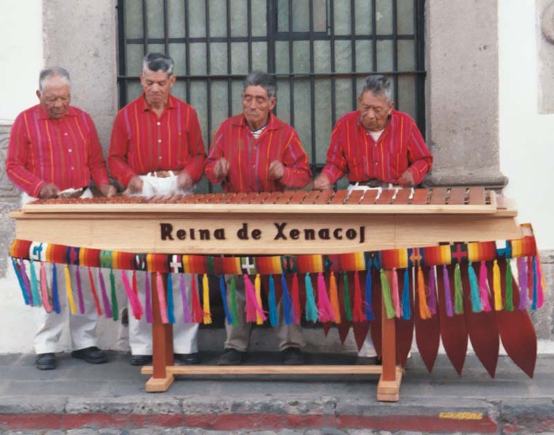 |
Antigua
Location : Antigua Marimba |
 |
Guatemala City (Capitol)
Location : Guatemala City Street Vendor |
 |
Guatemala City (Capitol)
Location : Guatemala City Market |
 |
Guatemala City (Capitol)
Location : Guatemala City Downtown Zona Quattro (Zone 4) Burned down after a fireworks accident during New Year's 2004. Notice the child playing in the construction zone. |
 |
Guatemala City (Capitol)
Location : Guatemala City Lemon Runner / Manual Delivery in Open Market |
 |
Guatemala City (Capitol)
Location : Guatemala City Future Chicken Burger |
 |
Guatemala City (Capitol)
Location : Guatemala City Resting |
 |
Guatemala City (Capitol)
Location : Guatemala City Tracks |
 |
Guatemala City (Capitol)
Location : Guatemala City Next to the tracks |
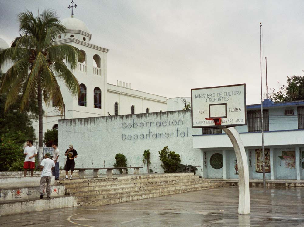 |
Flores
Location : Flores The Province capital of the district of Flores. Flores is the closest city to Tikal, thus it is a launching point to visit Tikal. |
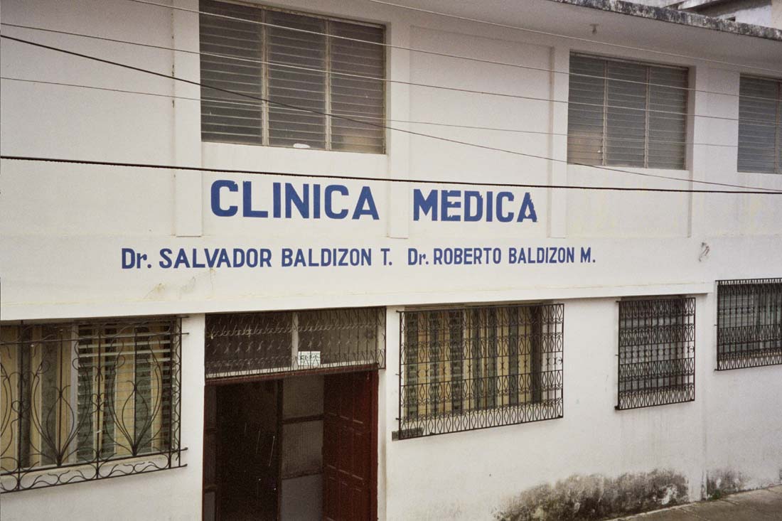 |
Flores
Location : Flores Clinic/Hospital for Flores |
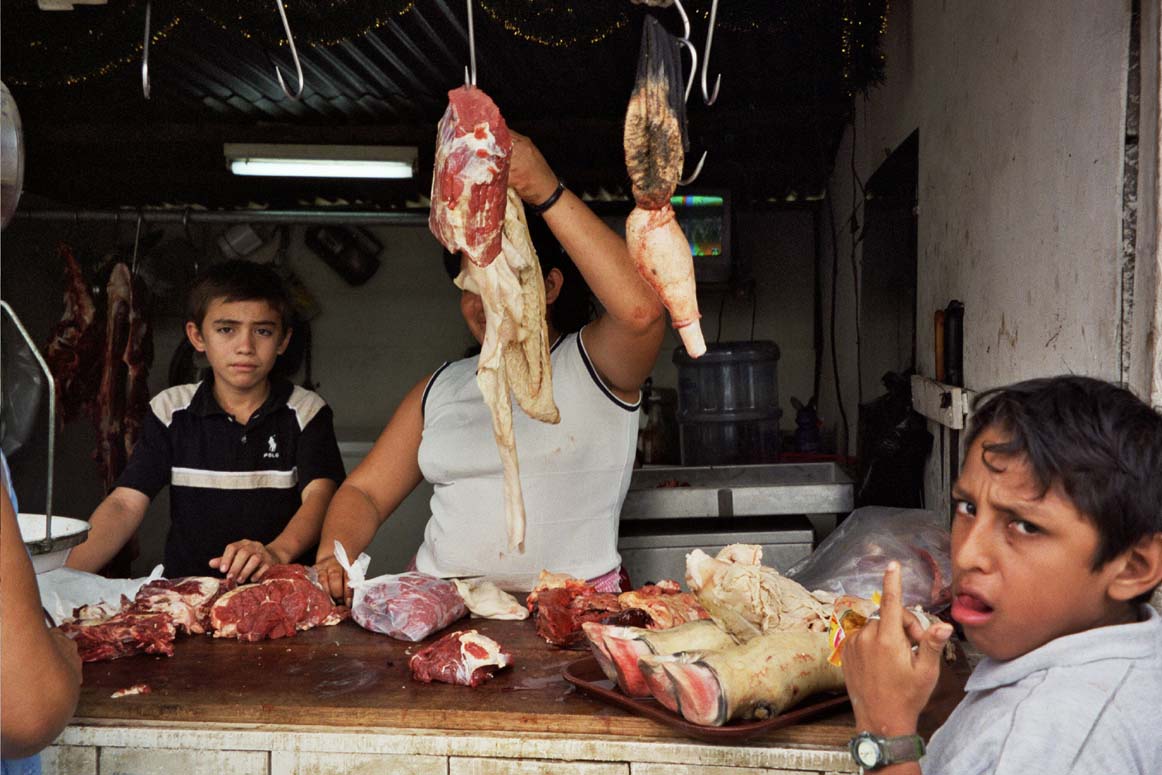 |
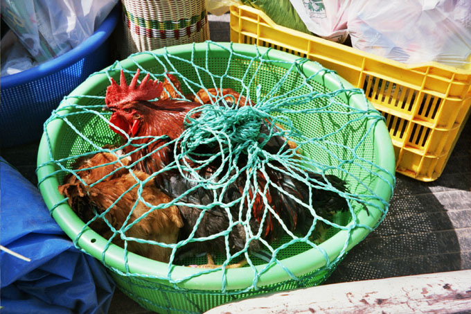
Santa Elena
Location : Santa Elena Meat (chickens) being sold in the open air market. |
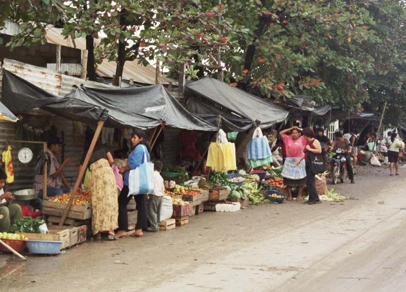 |
Santa Elena
Location : Santa Elena open market. Santa Elena is just over the bridge from Flores (Flores is the Jumping off point to visit Tikal) |
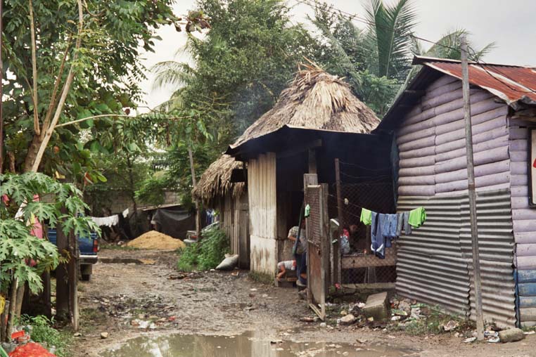 |
Santa Elena
Location : Santa Elena Typical Residence. |
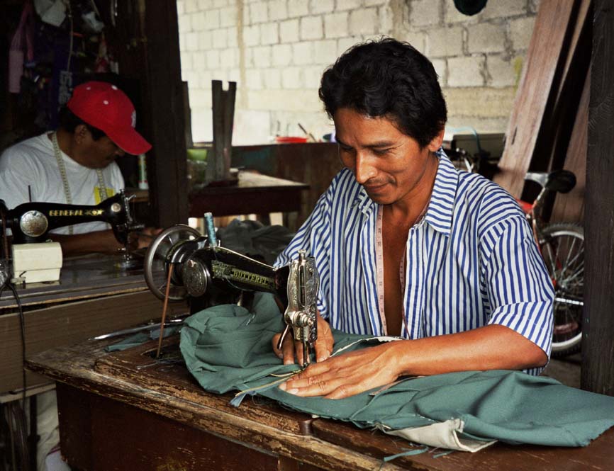 |
Santa Elena
Location : Santa Elena A Tailor |
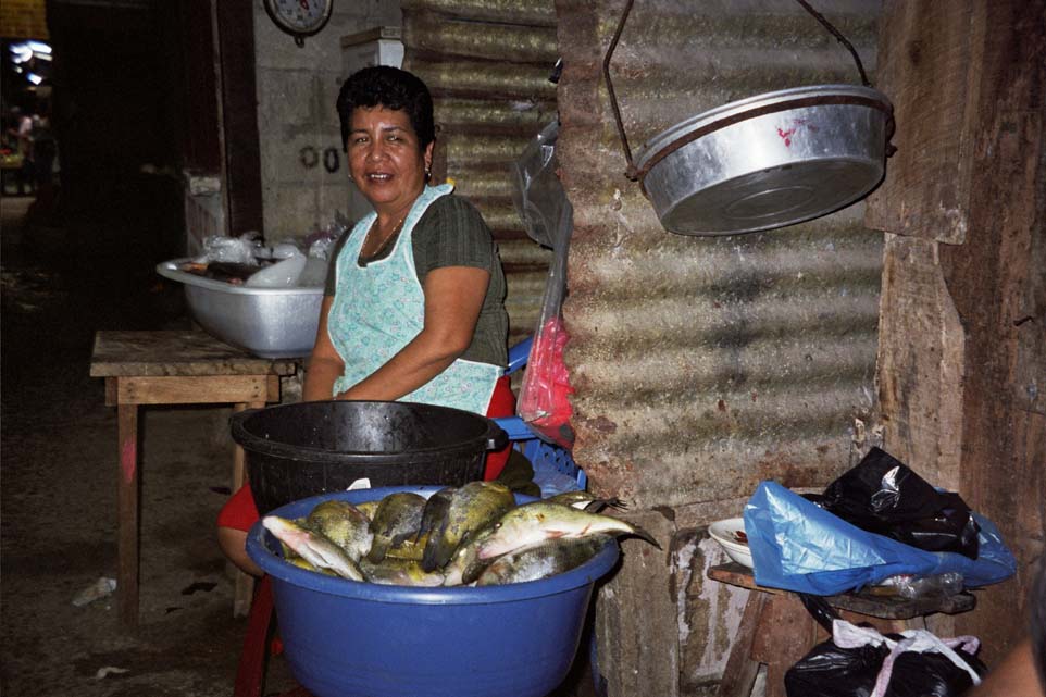 |
Santa Elena
Location : Santa Elena Open Air Market selling Fish. |
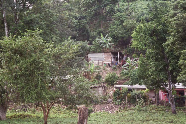 |
Santa Elena
Location : Santa Elena Residence near Grutas Aktunkan (Caves Aktunkan) |
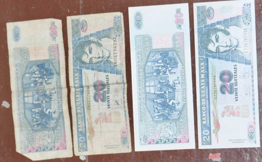 |
Chiqimula
Location : Chiqimula Bills in Guatemala are used to the point of tatters, sweaty gross and worn out. |
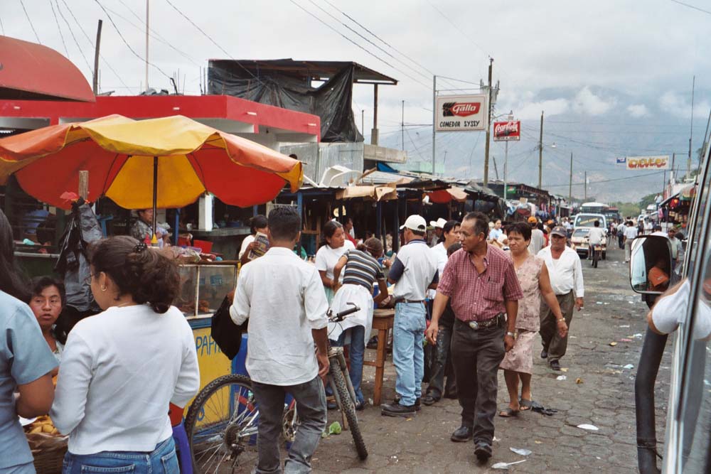 |
Chiqimula
Location : Chiqimula Open Market in Chiqimula. Chiqimula is on the way back from Honduras towards Guatemala City. |
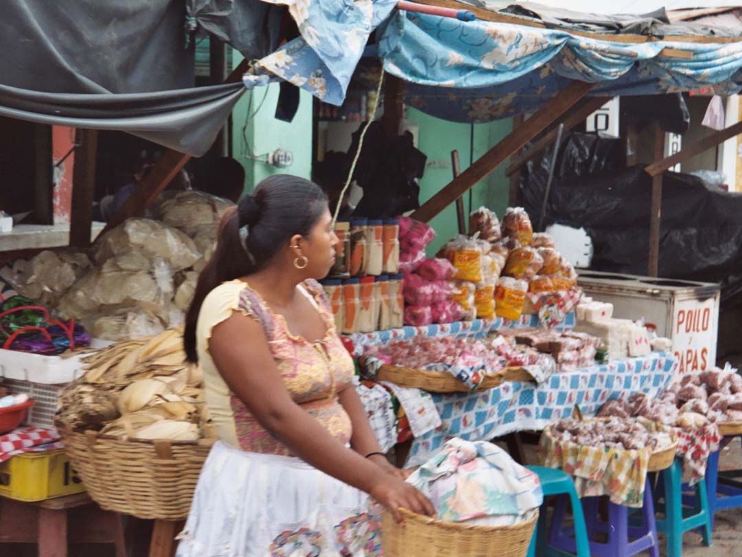 |
Chiqimula
Location : Chiqimula Open Air Market. |
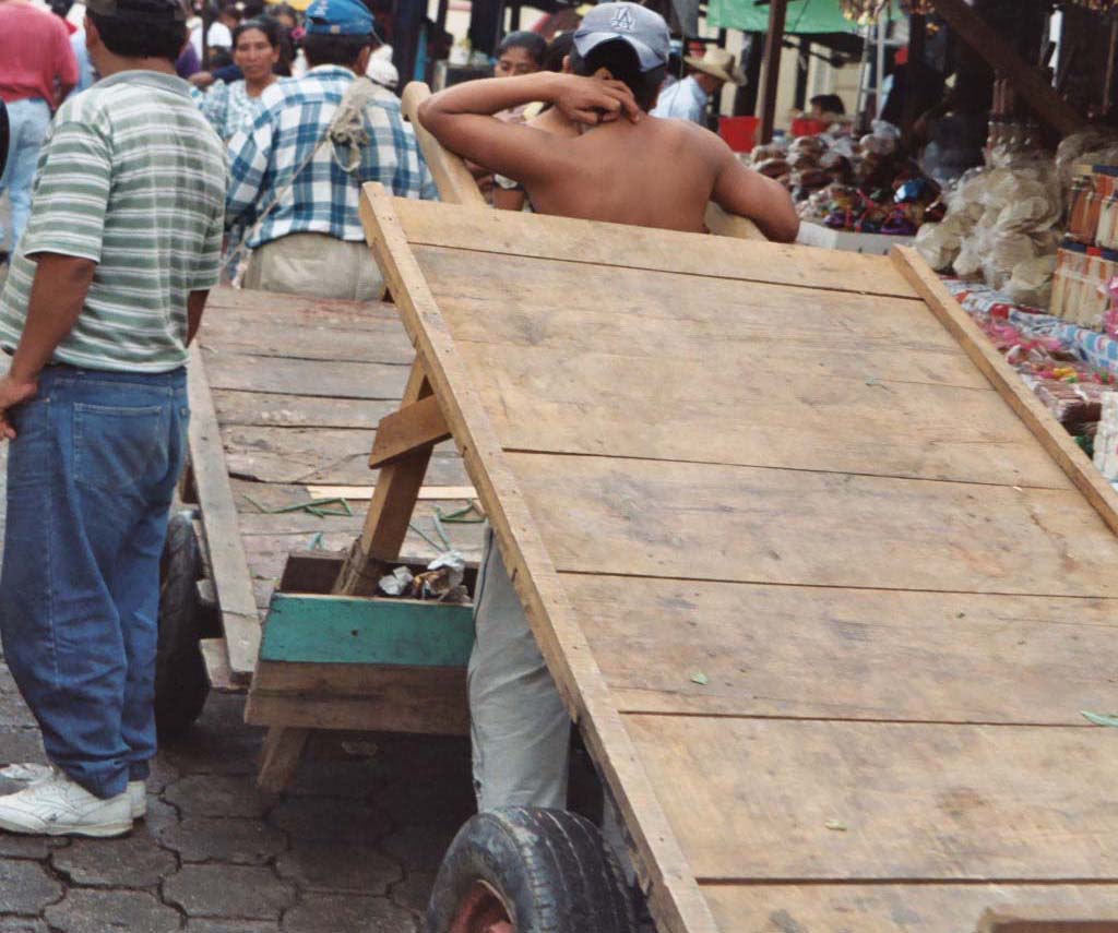 |
Chiqimula
Location : Chiqimula Manual Labor is common. |
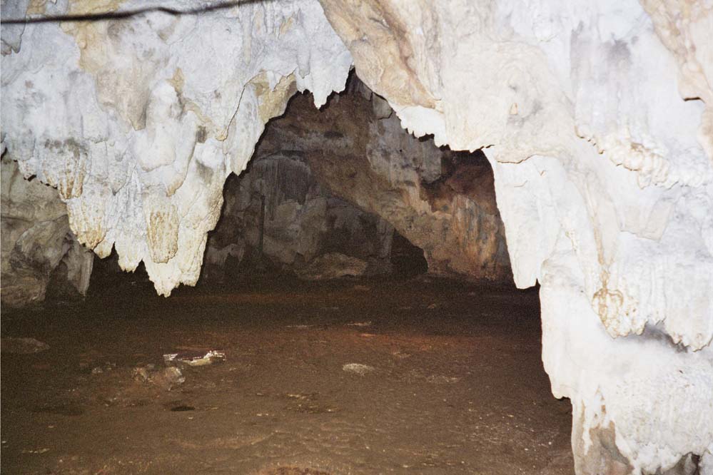 |
Grutas Aktun-kan
Location : Grutas Aktun-kan Grutas (Caves) / Just outside of Santa Elena |
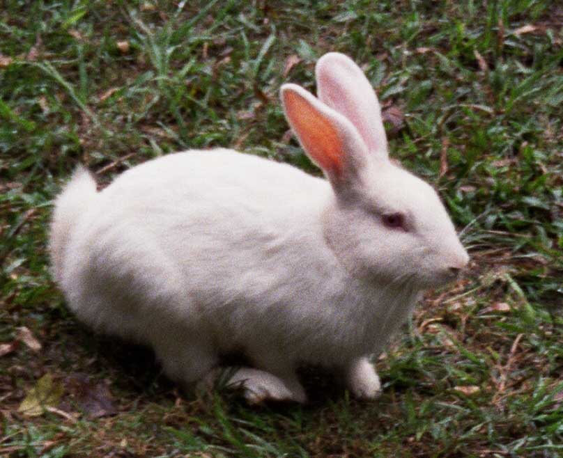 |
Grutas Aktun-kan
Location : Grutas Aktun-kan Rabbit outside Grutas Aktun-kan |
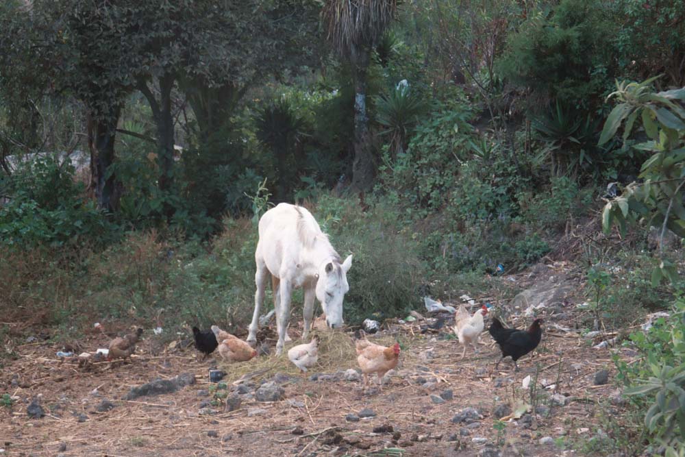 |
Volcan Pacaya
Location : Volcan Pacaya Animals at the start of the hike up Volcan Pacaya. Pacaya is a fruit. |
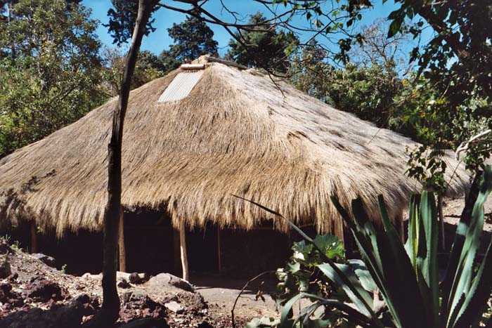 |
Volcan Pacaya
Location : Volcan Pacaya A House at the base of Volcan Pacaya. |
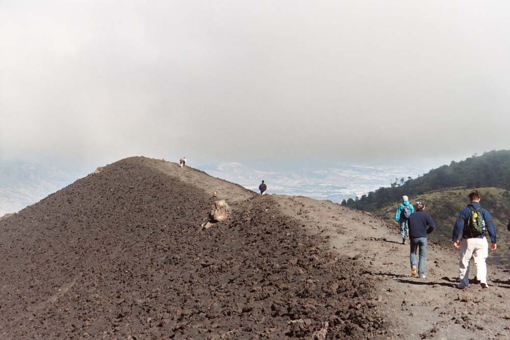 |
Volcan Pacaya
Location : Volcan Pacaya On the long hike up to the top of Volcan Pacaya. |
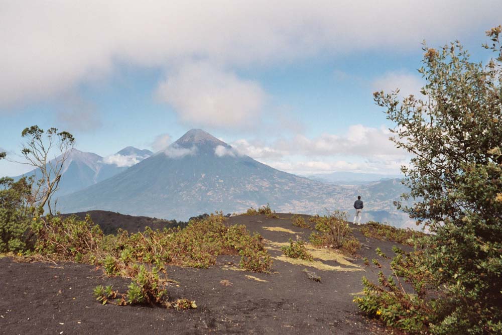 |
Volcan Pacaya
Location : Volcan Pacaya Spectacular views on the way up. We never made it to the top because the winds were too strong. |
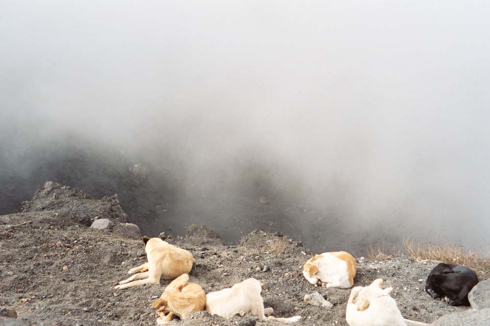 |
Volcan Pacaya
Location : Volcan Pacaya Dogs of the Volcano. |
 |
Panajachel
Location : Lago Atitlan Clothing vendor at Panajachel by the Beach. |
 |
Panajachel
Location : Lago Atitlan Docked boats by Lago Atitlan (Lake Atitlan). This is due west of Antigua by about an hour's drive. |
 |
Panajachel
Location : Lago Atitlan A light bulb with bare wires hanging out of a thatched roof at a restaurant we had lunch at in Panajachel. |
 |
Panajachel
Location : Lago Atitlan Pinatas. |
 |
Panajachel
Location : Lago Atitlan Market Scene. |