 FB
FB IN
IN| MEXICO |
| Mexico | Picture Description |
|---|---|

|
Mexico Stain Glass
Location: Mexico Stain Glass Window depicting Mexico at the Castile de Chapultapec. |
|
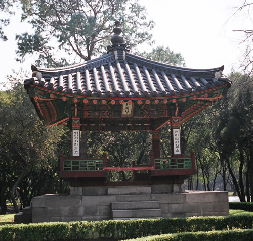
Chapultapec Park
Location: Mexico City A Korean Temple in Chapultapec Park. Chapultapec park is one of the biggest city parks in the world. It has 551 acres (220 hectares). There are vendors, souvenirs, a minniature train, auditorium and los pinos, home of Mexico's president. There are museums, a zoo and an amusement park (La Feria) |
|
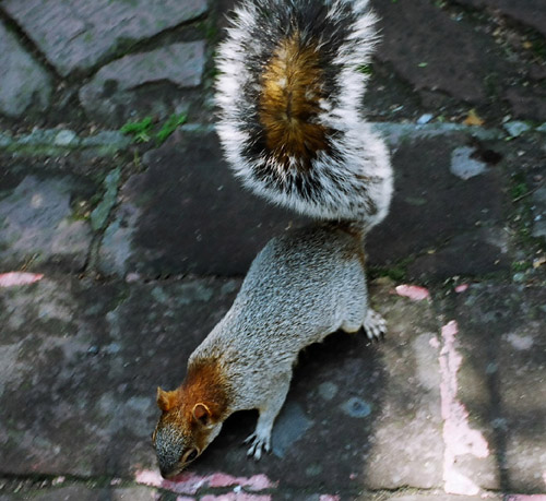
Chapultapec Park
Location: Mexico City The squirrels of Chapultapec park are very tame. Many tourists feed them obviously. This one walked right up to me, but I had no spare food at this time. I later got a chance to feed them peanuts. |
|
Chapultapec Park
Location: Mexico City Castille de Chapultapec as seen from the "Ground Level" |
|
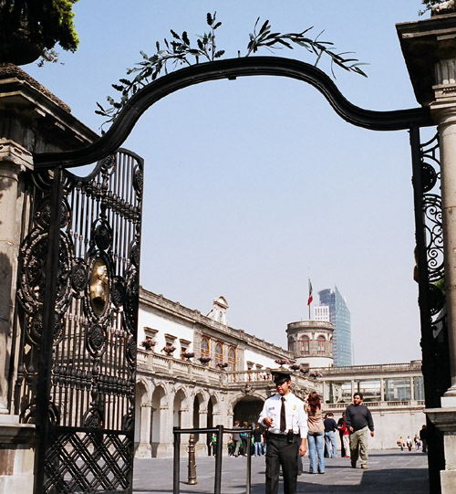
Castile de Chapultapec
Location: Mexico The Entrance to the Castle of Chapultapec |
|
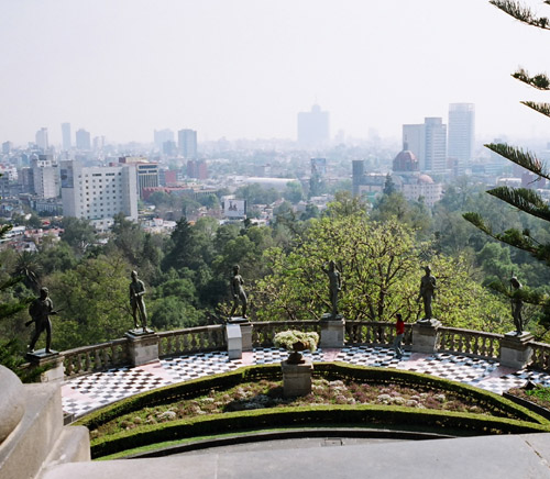
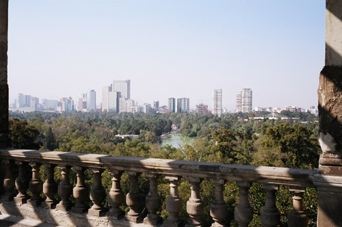
Castile de Chapultapec
Location: Mexico A view of Mexico City from Chapultapec Castle |
|
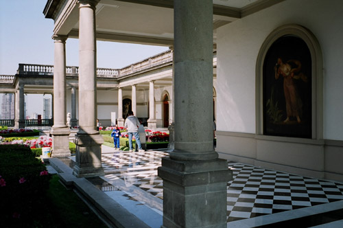
Castile de Chapultapec
Location: Mexico Second floor inside Capultapec Castle |
|
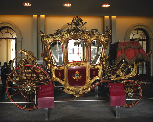
Castile de Chapultapec
Location: Mexico Carraiges of the day in the 19th century. |
|
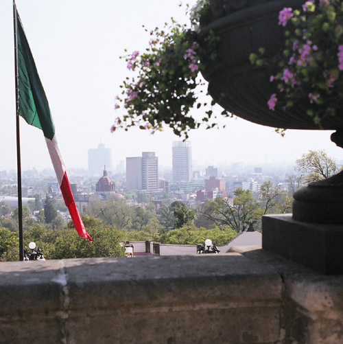
Castile de Chapultapec
Location: Mexico View from Capultapec Castle and the Mexican Flag in the backgroun the Basilica, modeled after the Santa Maria del Fiore in Italy. |
|
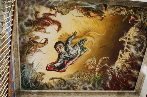
Castile de Chapultapec
Location: Mexico A ceiling picture in Chapultapec Castle. Pictures (Frescoes) like this are common throughout the Rennaisance showing off the techniques of Perspective that were developed during that time (1400-1500). |
|
Castile de Chapultapec
Location: Mexico A view of Mexico City |
|
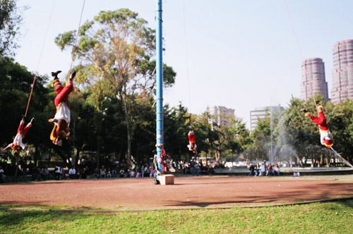
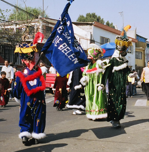
Performers
Location: Mexico Performers in Mexico City |
|
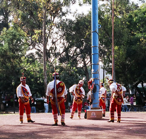
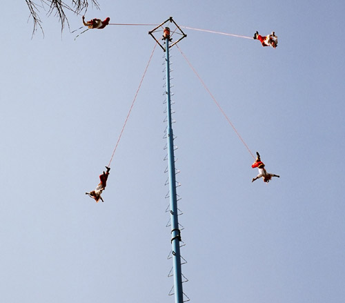
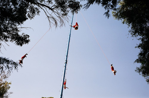
Performers
Location: Mexico Performers climbed up the top of a tall pole. |
|
Performers
Location: Mexico They attached harnesses around their belt, wound up a rotating square at the top of the pole. |
|
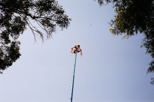
Performers
Location: Mexico Then they start spinning and falling upside down. All the while they are playing on a flute a traditional mexican song. |
|
Performers
Location: Mexico When they reach close to the land, they turn over in their harnesses and stop. |
|
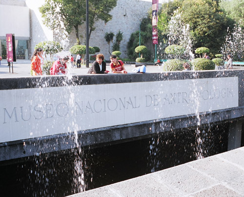
Anthropology Museum
Location: Mexico A view from the front of the Anthropology Museum |

|
Anthropology Museum
Location: Mexico The Anthropology Museum holds many valuable artifacts in a rotating display. This is the entrance. |
|
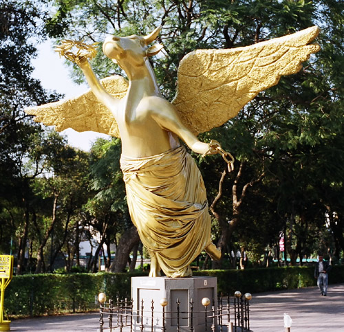
Holy Cow!
Location: Mexico Holy Cow! |
|
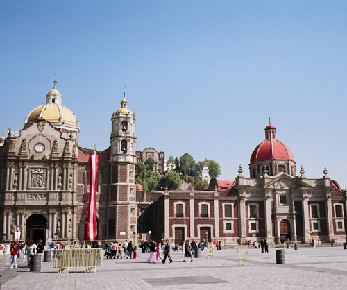
Basillica
Location: Mexico A complex of 5 churches in Mexico City. |

|
Mexico City
Location: Mexico The outskirts of Mexico City on the Way to Teotihuacan. |
|
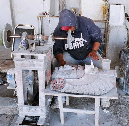
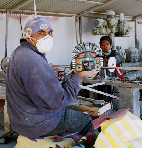
TEOTIHUACAN
Location: Teotihuacan Workers at Teotihuacan carve stone Aztec masks and other artifact replicas using Power tools. |
|
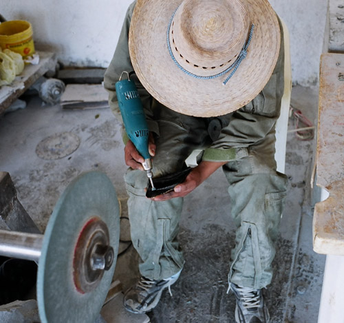
TEOTIHUACAN
Location: Teotihuacan Workers at Teotihuacan carve stone Aztec masks and other artifact replicas using Power tools. |
|
TEOTIHUACAN
Location: Teotihuacan Workers at Teotihuacan carve stone Aztec masks and other artifact replicas using Power tools. |

|
TEOTIHUACAN
Location: Teotihuacan Workers at Teotihuacan carve stone Aztec masks and other artifact replicas using Power tools. |
|
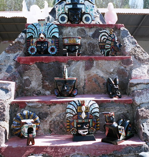
TEOTIHUACAN
Location: Teotihuacan The product of their work. |
|
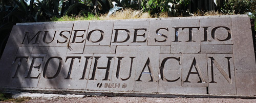
TEOTIHUACAN
Location: Teotihuacan The Entrance to the Teotihuacan Site. It was a city of 200,000 during the Aztecs, and was occupied since about 500 BC. |
|
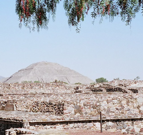
TEOTIHUACAN
Location: Teotihuacan Teotihuacan is a UNESCO (United Nations) World Heritage Site. At its zenith around 500 AD, it had more inhabitants than its contemporary, Rome. Its magnificent pyramids and palaces covered 12 square miles (31 sq km). |
|
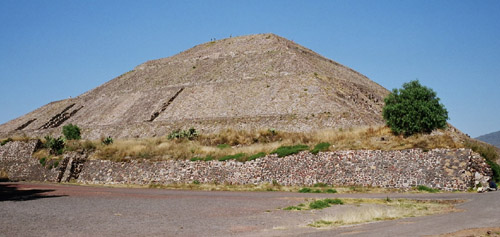
TEOTIHUACAN
Location: Teotihuacan This is the Temple of the Sun. Construction began on the Pyramid of the sun in 100BC, |
|
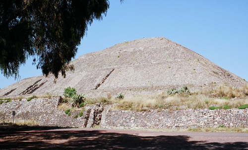
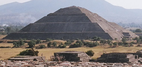
TEOTIHUACAN
Location: Teotihuacan The pyramid of the sun is the world's third largest Pyramid. The first and second are the Great Pyramid of cholula (Puebla) and the pyramid of Cheops (Cairo, Egypt). Teotihuacan's Pyramid of the sun is 730 Feet (221m) per side at its base, almost as large as Cheops. But at 210 feet (64m) it is only half as high. |
|
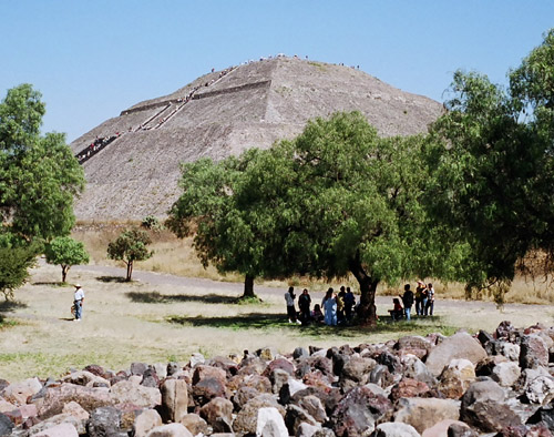
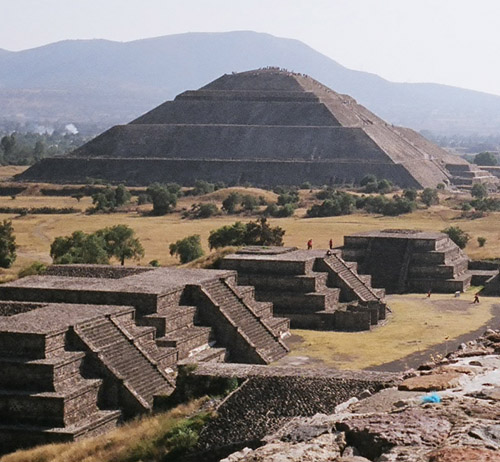
TEOTIHUACAN
Location: Teotihuacan Another view of the Pyramids, what the locals call "Pyramedes". It is the biggest restored pyramid in the Western Hemisphere and an awesome sight. It was built on top of a series of sacred caves (not open to the public). |
|
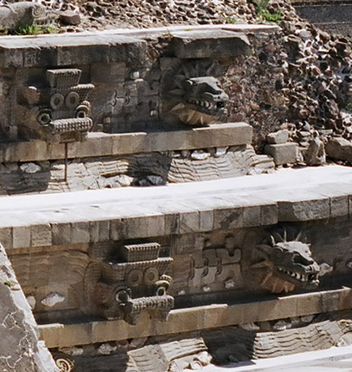
TEOTIHUACAN
Location: Teotihuacan This is the temple of Quetzalcoatl located within the La Ciudadela just off the Avenue of the Dead. Ciudadela was a massive citadel ringed by more than a dozen temples. The Templo de Quetzalcoatl was the centerpiece. There detailed carvings of the benevolent deity Quetzalcoatl (Plumed Serpent). |
|
TEOTIHUACAN
Location: Teotihuacan The Temple of the Moon, near the Temple of the Sun. |
|
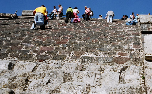
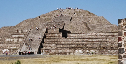
TEOTIHUACAN
Location: Teotihuacan The climb up to the top of the Pyramid of the Sun is 242 steps. The steps get taller the higher you go, but the view from the top is very nice. There are a few tiers that you can stop and look around. |
|
TEOTIHUACAN
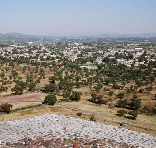
Location: Teotihuacan A Picture from the top of the Pyramid of the Sun, you can see the vast urban sprawl of Mexico City. It is a worthwhile 248 step climb to the top. Teotihuacan's decline caused by overpopulation and depletion of natural resources, took 250 years. Eventually the people were poorly nourished and the city was deliberately burned. |
|
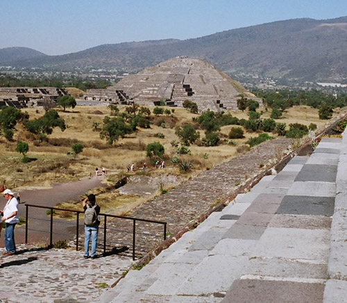
TEOTIHUACAN
Location: Teotihuacan Temple of the Moon. Here to the left of the picture you can see one end of the Avenue of the Dead, and the Palace of Quetzalpapalotl and the Palace of the Jaguars. It got the name Avenue of the dead because the Aztecs mistook the little mounds along both sides of the avenue as tombs for dead kings. |
|
TEOTIHUACAN
Location: Teotihuacan Pyramid of the Moon (Piramide de la Luna). There was a royal tomb unearther here, and in late 2002, a discovery of jade objects gave evidence of a link between the Teotihuacan rules and the Maya. |
|
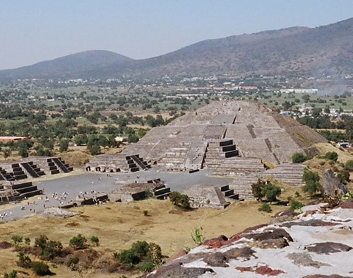
TEOTIHUACAN
Location: Teotihuacan The Pyramid of the Sun taken from the Pyramid of the Moon with the mistaken burial mounds in the foreground. There is evidence of more than 4,000 adobe and stone dwellings that surround hte avenue of the dead. |
|
TEOTIHUACAN
Location: Teotihuacan The Pyramid of the Sun taken from the Pyramid of the Moon The pyramid of the sun was probably built about a century before Christ, and was completed 400 years later in 300 AD. It was restored in the 20th century. |
|
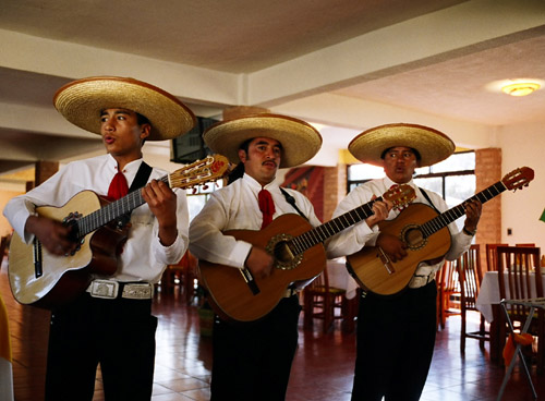
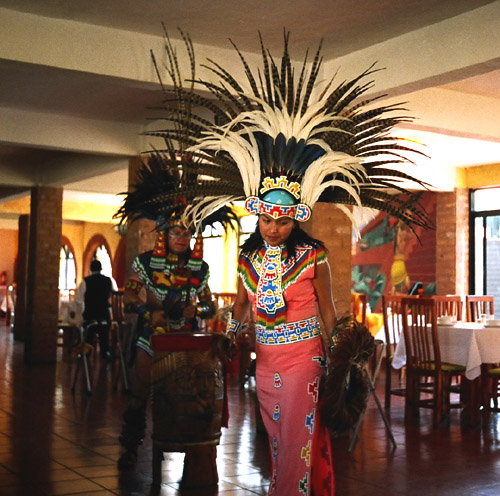
Restaurant
Location: Teotihuacan Performers at a restaurant near Teotihuacan. |
|
Restaurant
Location: Teotihuacan Performers at a restaurant near Teotihuacan. |

|
MEXICO CITY
Location: Mexico The outskirts of Mexico City. |
|
XOCHIMILCO
Location: Xochimilco Xochimilco is a Venice-like city. It has been around since the time of the Aztecs and has 50 miles of canals. Today, the city has a population of 300,000. |
|
XOCHIMILCO
Location: Xochimilco Xochimilco is a UNESCO World Heritage Site in 1987. I got there using the Metro for 2 pesos (about $0.20 USD) and then a Tren Ligero (Light train) which also cost 2 pesos! |
|
XOCHIMILCO
Location: Xochimilco Xochimilco is a collection of man-made islands divided by canals. |
|
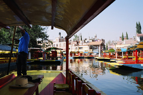
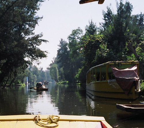
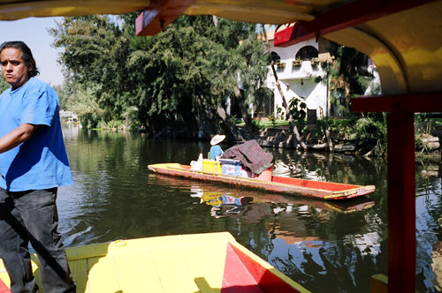
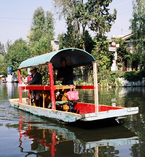
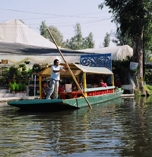
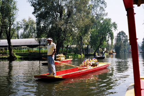
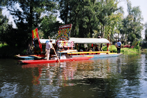
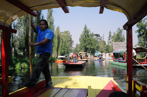
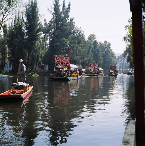
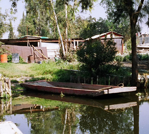
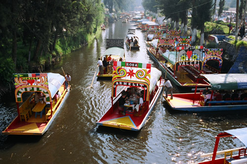
XOCHIMILCO
Location: Xochimilco Hundreds of boats tootle up and down the canals every day. |
|
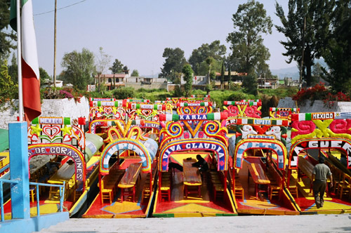
XOCHIMILCO
Location: Xochimilco Many specialize boats cater to tourists. This boat is a music-boat with an on-board live band that will play music for your boat for a modest fee. |
|
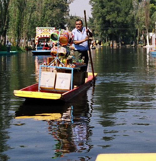
XOCHIMILCO
Location: Xochimilco Markets and landings run up and down the canals. |
|
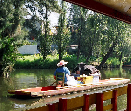
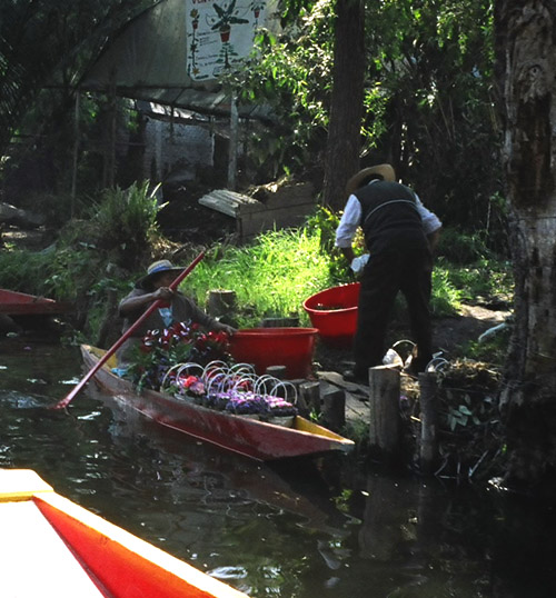
XOCHIMILCO
Location: Xochimilco A boat selling flowers. |
|
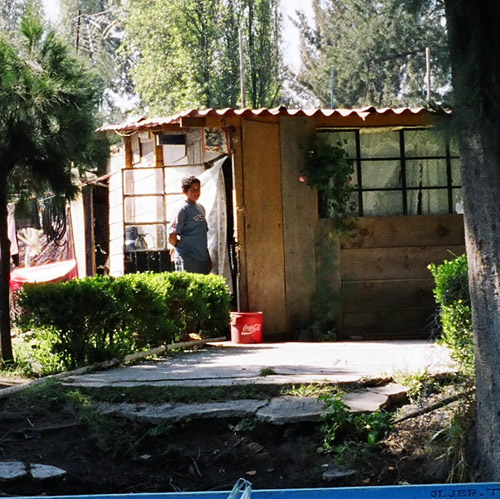
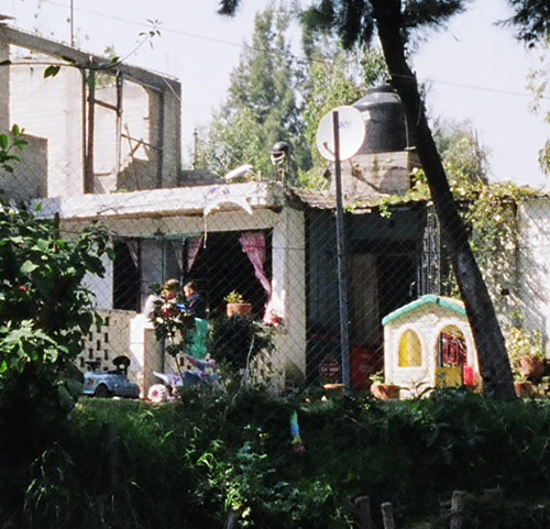
XOCHIMILCO
Location: Xochimilco A home next to the canals. Xochimilco is considerably poorer than Mexico City. But, the people seem happy and friendly nonetheless. |
|
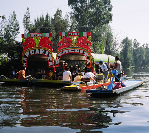
XOCHIMILCO
Location: Xochimilco Each boat has a name, pictured here are the "Margarita" and "Teresita", or "Little Marge" and "Little Terry". The boats are called Trajineras. |
|
XOCHIMILCO
Location: Xochimilco Xochimilco comes from the Nahuatl, Xochitl = flower, Milli = cultivated Field. |
|
XOCHIMILCO
Location: Xochimilco The first settlements dates around the late Pre-Classic period from 200 BC to 250 AD. |
|
XOCHIMILCO
Location: Xochimilco It was originally comprised of the Chichimec tribes, and the Xochimilcas. The Xochimilcas arrived between the 10th and 14th centuries. |
|
XOCHIMILCO
Location: Xochimilco The Xochimilcas invented the Chinampa, the agricultural square, and founded the city of Xochimilco. The Chinampa agricultural technique was developed by the Nahuatlacas tribes. |
|
XOCHIMILCO
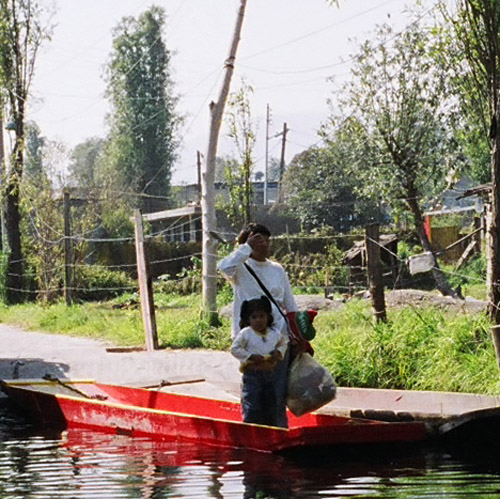
Location: Xochimilco This is a Chinampas, or little Island, which Xochimilco is comprised of. This is a picture of a typical family living there. |
|
XOCHIMILCO
Location: Xochimilco Today, Xochimilco is one of sixteen Mexican delgations (delegaciones) within the Mexican Federal District. It is located south of Mexico City. |
|
XOCHIMILCO
Location: Xochimilco Today, agriculture in Xochimilco is important but a minor activity. The canals are only a small fraction of their former extent. |
|
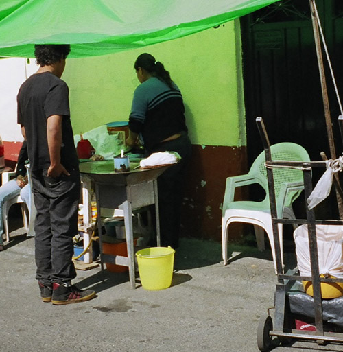
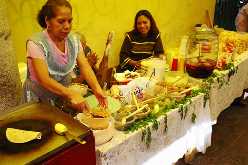
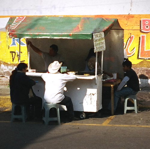
XOCHIMILCO
Location: Xochimilco Food stalls selling a variety of simple, but authentic mexican dishes dot the streets. |
|
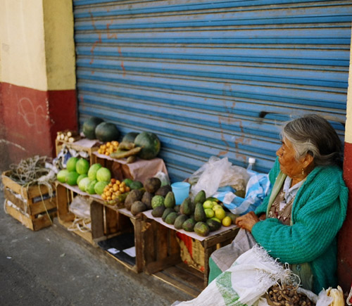
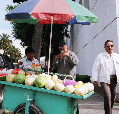
XOCHIMILCO
Location: Xochimilco Here a lady sells fruit. |
|
XOCHIMILCO
Location: Xochimilco A typical residence. |
|
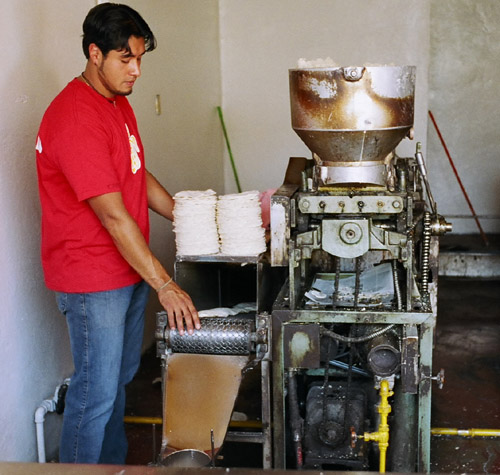
XOCHIMILCO
Location: Xochimilco A tortilla making machine! This gentleman was kind enough to let me try a tortilla freshly made "hot off the press". I saw people buy packages of tortillas. |
|
XOCHIMILCO
Location: Xochimilco This is where I had lunch in Xochimilco, a chicken torta (kind of like a sandwich roll) cost $1.20 USD. I had two of them which made a satisfying meal. I had to pay to use the restrooms nearby. |
|
XOCHIMILCO
Location: Xochimilco A crowd celebrating something, I'm not sure what. Xochimilco hosts an amazing 422 festivals annually, the most famous of which celebrates the Ninopa, a figure of the Christ child. |

|
XOCHIMILCO
Location: Xochimilco This is another part of Xochimilco. You can arrive here by bus or walking. It is a national park with extensive canals. |
|
XOCHIMILCO
Location: Xochimilco Xochimilco thrives on tourism. |
|
XOCHIMILCO
Location: Xochimilco I saw a swarm of boats in area of Xochimilco. |
|
XOCHIMILCO
Location: Xochimilco Another food stall in Xochimilco |
|
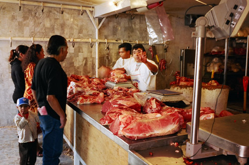
XOCHIMILCO
Location: Xochimilco An open meat market in Xochimilco. Though not refridgerated, it was much cleaner than the open meat markets I saw in Guatemala. |
|
Mexico City
Location: Mexico City A food stall in Mexico City |
|
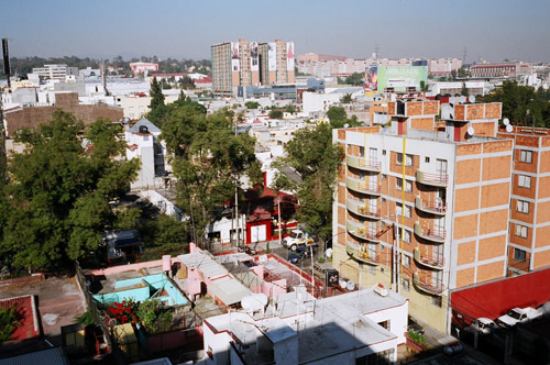
Mexico City
Location: Mexico City A picture taken from the Rooftop of the Holiday Inn Trade Center, Ave Revolucion that I stayed at. |
|
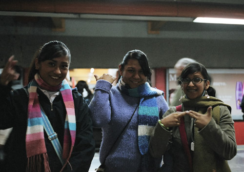
Mexico City
Location: Mexico City These are three deaf people that I met in Mexico City. Because I teach American Sign Language (ASL), I made contact with them and with the use of a Spanish phrase book, I got to learn a little bit of Mexican Sign Language. The alphabet is nearly identical to ASL. |
|
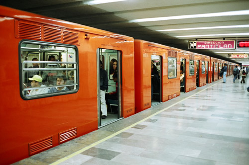
Mexico City
Location: Mexico City Here is a picture of the Mexico City Metro (Subway) system. Notice how clean it is. It cost 2 pesos or about $0.20 for a one-way ride to anywhere in the city. |
|
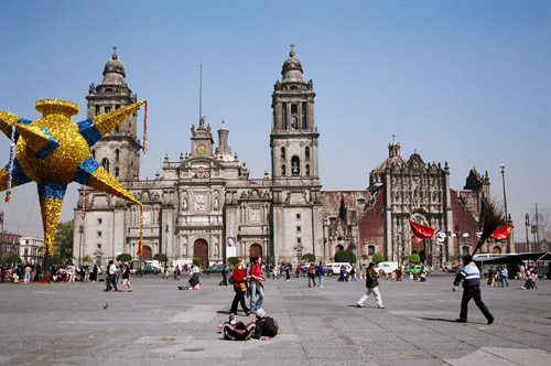
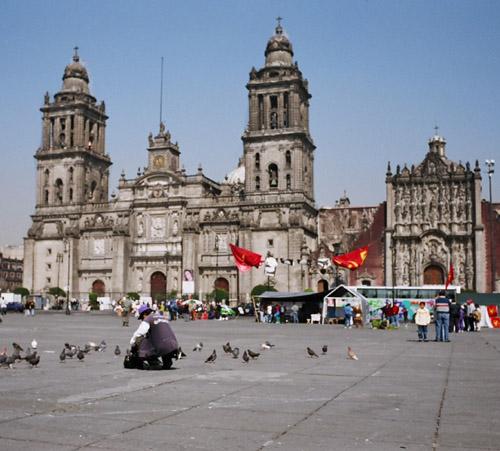
Mexico City
Location: Mexico City This is the Cathedral to the north of MExico City Zocalo. |
|
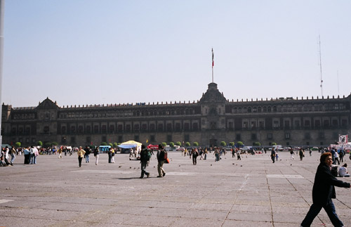
Mexico City
Location: Mexico City The Mexico City Zocalo is the world's third largest square. |

|
Mexico City
Location: Mexico City Numerous vendors sell all sorts of things in the Zocalo, which has its own subway station stop. There was a huge tent with vendors selling things on the south side. |
|
Mexico City
Location: Mexico City At night when I went to the Zocalo, a band was performing on a stage with enormous speakers. |
|
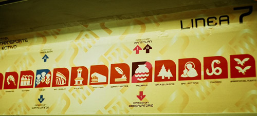
Mexico City
Location: Mexico City All of the subway maps, trains and subway stops used a combination of symbols and words to indicate stops. I found this to be more efficient than the US subway systems. |