 FB
FB IN
IN| VENEZUELA |
| VENEZUELA | Picture Description |
|---|---|
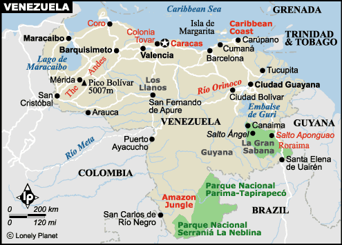 |
Map of venezuela
Population : 25,375,281 (2005) Median age: 25.6 years Fertility rate:2.26 children/woman(04) Currency: Bolivar (VEB) GDP per capita: PPP $6,400 (2005) Population below poverty line: 47% Labor force - by occupation: Agriculture 4.6%, Industry 48.2%, Services 47.2% Source : CIA Factbook |
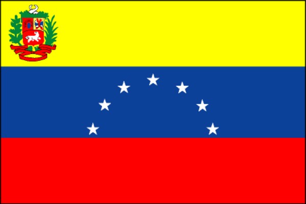 |
The National Flag of Venezuela
Venezuela was one of three countries that emerged from the collapse of Gran Colombia in 1830 (the others being Colombia and Ecuador). For most of the first half of the 20th century, Venezuela was ruled by generally benevolent military strongmen, who promoted the oil industry and allowed for some social reforms. Democratically elected governments have held sway since 1959. Current concerns include: a weakening of democratic institutions, political polarization, a politicized military, drug-related violence along the Colombian border, increasing internal drug consumption, overdependence on the petroleum industry with its price fluctuations, and irresponsible mining operations that are endangering the rain forest and indigenous peoples. |
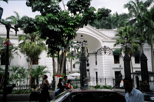 |
Caracas
Location: Venezuela This is the capital building of the Capitol of Venezuela, Caracas. |
 |
Caracas
Location: Venezuela Here I am standing in front of the capital building. |
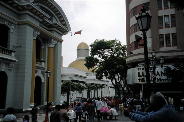 |
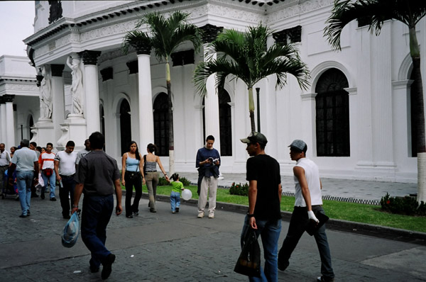
Caracas
Location: Venezuela The capital building has mass crowds of people casually parading past it. |
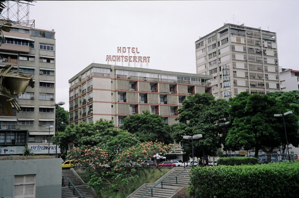 |
Caracas
Location: Venezuela The Hotel Monserrat is where we stayed, friendly clean, and reasonably priced. |
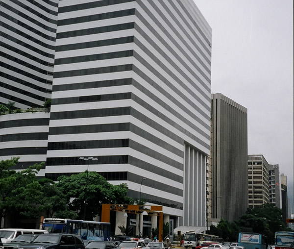 |
Caracas
Location: Venezuela Caracas is a modern first world city. Venezuela is one of the richest countries in South America, made rich by oil money. But the far reaches of the country are still poor. |
 |
Jimmie Angel's Plane
Location: Venezuela Jimmie Angel discovered Angel Falls, the world's tallest waterfall. |
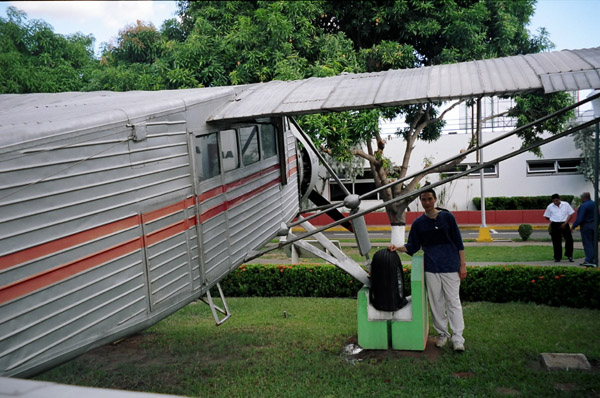 |
Jimmie Angel's Plane
Location: Venezuela Jimmy Angel landed on the top of the tepuy. His Flamingo monoplane settled into the marshy ground atop Auyan-tepui and the plane remained there for 33 years before being lifted out by a helicopter. |
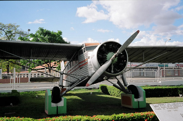 |
Jimmie Angel's Plane
Location: Venezuela Jimmy Angel was a barnstorming bush pilot from Missouri, USA. He first saw the falls in 1933 while searching for a valuable ore bed. He returned in 1937 with his wife, Gustavo Heny. Jimmy Angel and his companions managed to descend the tepui and make their way back to civilization in 11 days. |
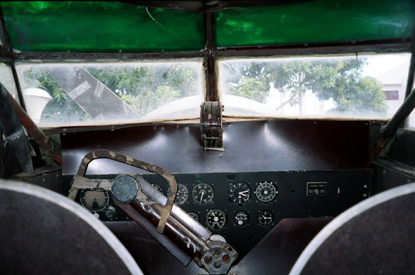 |
Jimmie Angel's Plane
Location: Venezuela The cockpit view of the airplane. |
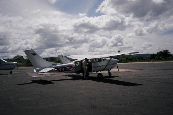 |
Aerial view of Venezuela
Location: Venezuela This is the first step to get to see Angel Falls, the World's Tallest waterfall. Many tour operators can take you to the falls. It requires a propellor plane trip to the tropical rainforest (which take about 1-3 hours depending on where you leave from). |
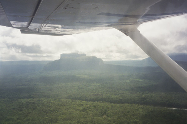 |
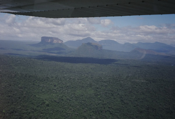
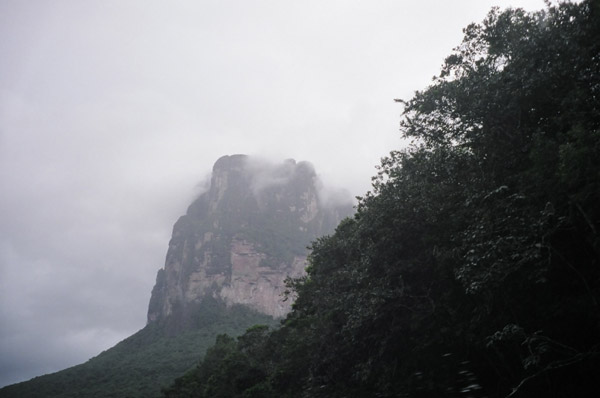
Aerial view of Venezuela
Location: Venezuela This is a Tepuy, a plateau and inselberg like geological structure. It is off one of these Tepuy, that Angel Falls runs off. |
 |
Aerial view of Venezuela
Location: Venezuela The plane offers spectacular views of Venezuela. |
 |
Aerial view of Venezuela
Location: Venezuela This is a view of falls near the landing point of one of the park entrance. |
 |
Aerial view of Venezuela
Location: Venezuela This is a view shortly after taking off. |
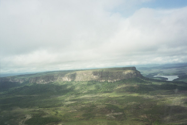 |
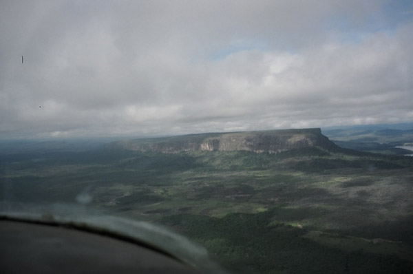
Aerial view of Venezuela
Location: Venezuela This is a beautiful view of a Tepuy. They range in height, many are over 2,000 feet tall. |
 |
Aerial view of Venezuela
Location: Venezuela More Aerial views. |
 |
Aerial view of Venezuela
Location: Venezuela More Aerial views. |
 |
Aerial view of Venezuela
Location: Venezuela More Aerial views. |
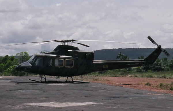 |
Aerial view of Venezuela
Location: Venezuela The small airport at the landing site in Canaima has a helicopter. |
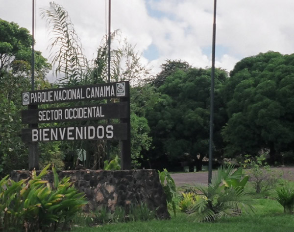 |
Canaima National Park
Location: Venezuela Canaima national park entrance. Note - this "park" is vast. The word vast doesn't begin to describe how mind-bogglingly huge this park is. It is hard to picture 2.5 million acres. It was established by Presidential decree on June 12, 1962. |
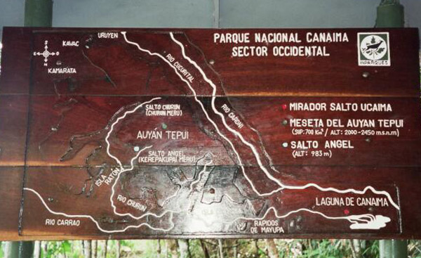 |
Canaima National Park
Location: Venezuela An overview map of the park. Canaima national park is Venezuela's second largest national park, includes rolling savannahs, forests, woodlands, cliffs, flat-topped table mountains (tepuis). |
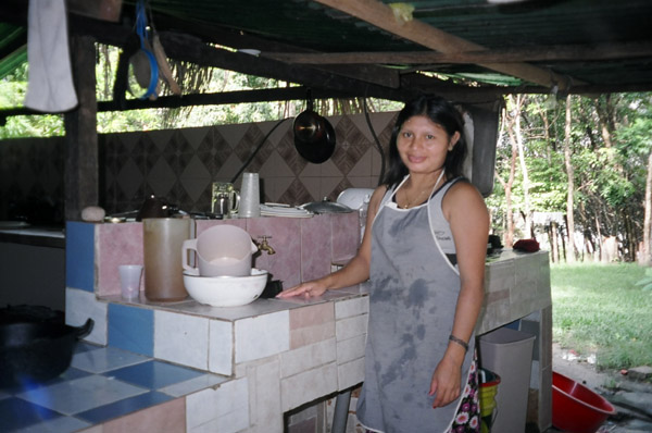 |
Canaima National Park
Location: Venezuela This is a member-worker of the Lodge we stayed at. |
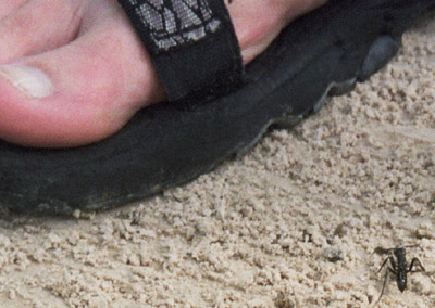 |
Canaima National Park
Location: Venezuela The ants are huge here in the park. |
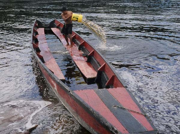 |
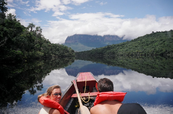
Canaima National Park
Location: Venezuela A man bails out water from this flooded canoe. These are the canoes needed to get to Angel falls. Later on in the day I saw this canoe, and it is free of water. (and didn't look to be taking on any more) |
 |
Canaima National Park
Location: Venezuela This is a picture of the rooms we stayed at in Canaima Waku Lodge. |
 |
Canaima National Park
Location: Venezuela This shortly after the plane ride. We are just about to debark on a long boat trip to get to the hike start point. |
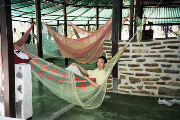 |
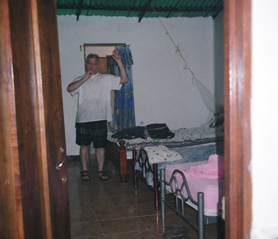
Canaima National Park
Location: Venezuela At Canaima Waku Lodge they have hammocks to rest/sleep in. Hammocks are difficult to sleep in as it tries to fold you in half overnight. |
 |
Canaima National Park
Location: Venezuela In the park are communities of original population that existed before the Spanish conquerors arrived. They live from agriculture cultivating yuca, corn, beans, fish, and fruits. Over 3000 people of the Arekuna, Kamaracota, and Yanomami indian groups live here. |
 |
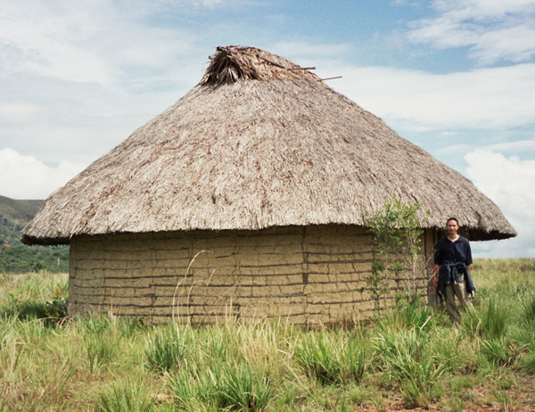
Canaima National Park
Location: Venezuela These round huts of the natives are called Churuata The roof is made of Palma Moriche (a variety of palm) from which they let hang hammocks to sleep in. |
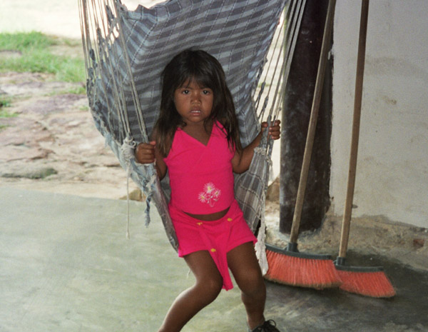 |
Canaima National Park
Location: Venezuela A picture of the daughter of the worker at the Waku Lodge. |
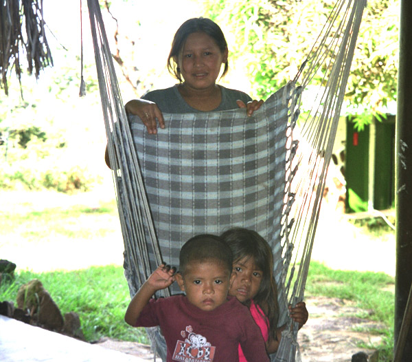 |
Canaima National Park
Location: Venezuela Mom and the two kids. |
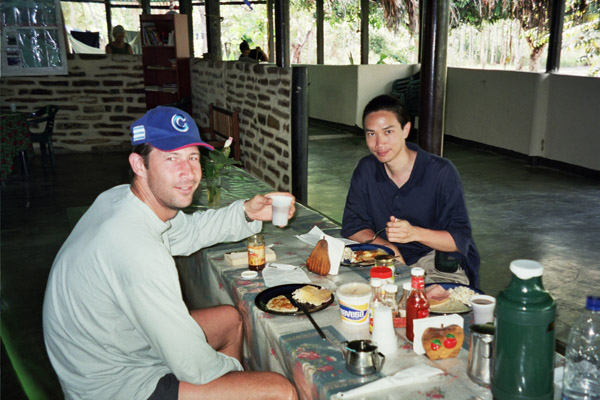 |
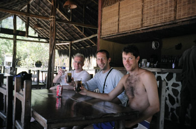
Canaima National Park
Location: Venezuela A western style meal at the lodge. |
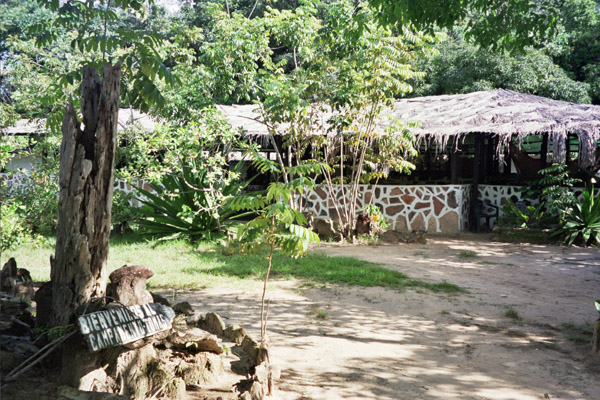 |
Canaima National Park
Location: Venezuela A welcome sign at the lodge. |
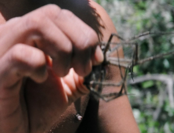 |
Canaima National Park
Location: Venezuela The spiders are pretty big here too. |
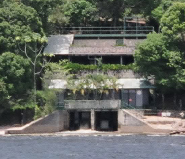 |
Canaima National Park
Location: Venezuela A water turbine generates power the lodge. The tour walks right through the generator, and you get a first hand look at how it operates. |
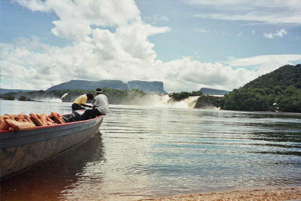 |
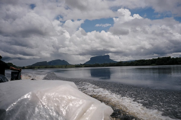
Canaima National Park
Location: Venezuela This is the beginning of the 3 hour boat tour to get to the camp site from where the hike to Angel falls will occur. |
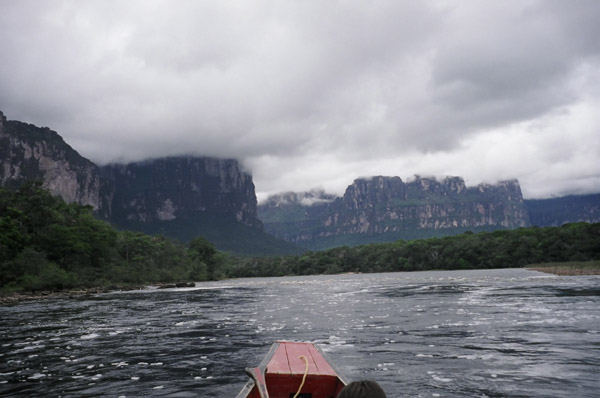 |
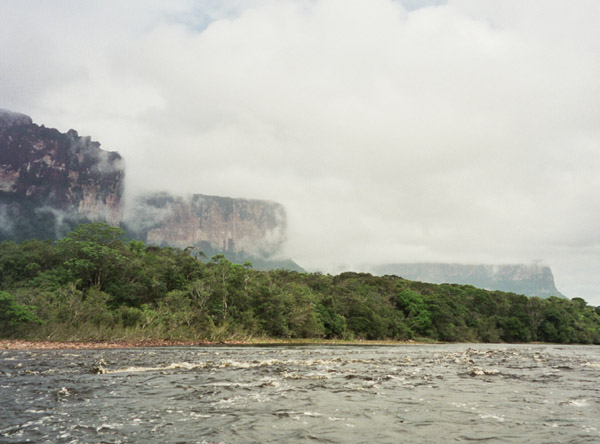
Canaima National Park
Location: Venezuela CLose up views of Tepuys from the motor boat. |
 |
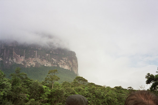
Canaima National Park
Location: Venezuela These tepuys, plateau like land formations are massive. Most are over 2000 feet tall. |
 |
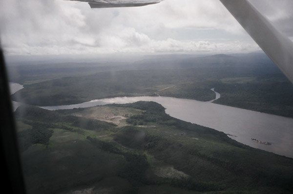
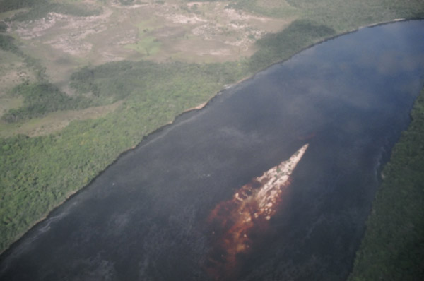
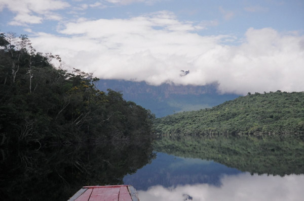
Canaima National Park
Location: Venezuela Winding rivers, bright blue flourescent birds. |
 |
Canaima National Park
Location: Venezuela More views of Tepuys. |
 |
Canaima National Park
Location: Venezuela More views of Tepuys. |
 |
Canaima National Park
Location: Venezuela More views of Tepuys. |
 |
Canaima National Park
Location: Venezuela More views of Tepuys. |
 |
Canaima National Park
Location: Venezuela More views of Tepuys. |
 |
Angel Falls
Location: Venezuela The next day, you take a 1.5 hour hike to get to the falls. |
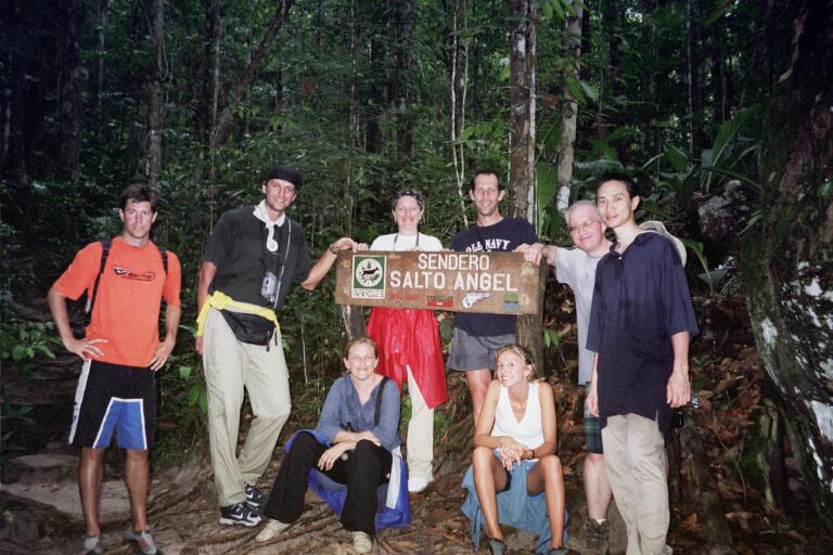 |
Angel Falls
Location: Venezuela A picture of the group. |
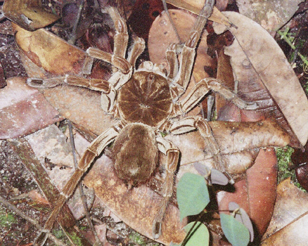 |
Angel Falls
Location: Venezuela At about 5:30PM I heard a rustling, and saw a flash of something, when I looked down I saw this spider. The spider was huge! |
 |
Angel Falls
Location: Venezuela This is a view at the mid-way point of the hike they offer a nice rest and beautiful views of the falls. |
 |
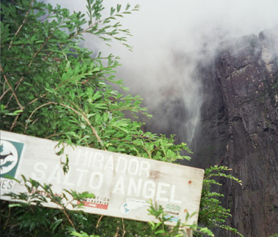
Angel Falls
Location: Venezuela Another view from the mid-way point of the hike (this is also where the sign is) |
 |
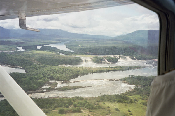
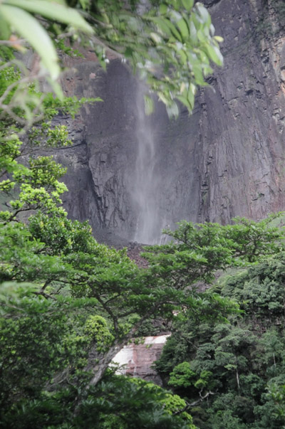
Angel Falls
Location: Venezuela There are many falls that drop off from Tepuys, but Angel Falls drops into a valley, thus making it taller than the other ones. |
 |
Angel Falls
Location: Venezuela A view of the falls. |
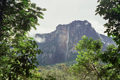 |
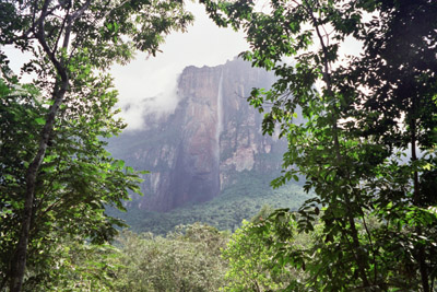
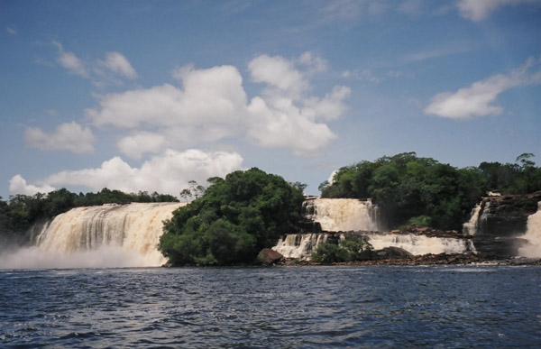
Angel Falls
Location: Venezuela This is one of the very first views of the falls taken from the camp site. This was taken shortly after the end end of the boat trip. |
 |
Angel Falls
Location: Venezuela The camp site is located not far from the boat landing, and offers a very nice far-away view of Angel Falls. |
 |
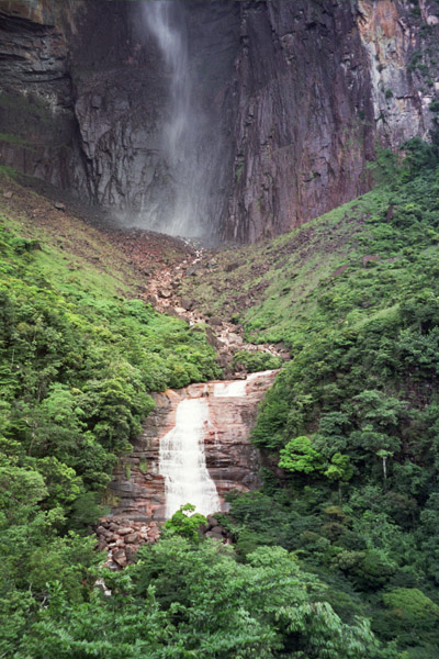
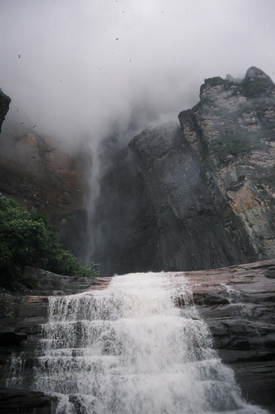
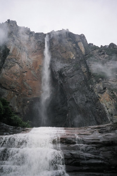
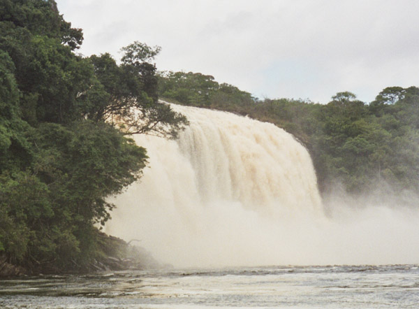
Angel Falls
Location: Venezuela Angel Falls is located in the Guayana highlands. Plunging off the edge of a Roraima, the highest tepui (table-top mountain) in the Guiana highlands, it free falls for 2,421 feet to the river below. this makes it the tallest waterfall on the earth. It is 15 times higher than NiagaraFalls, with a total height of 2,937 feet. |
 |
Angel Falls
Location: Venezuela 2,421 feet (737.92 meters) free fall drop, and total height of 2,937 feet (895.19 meters). |
 |
Angel Falls
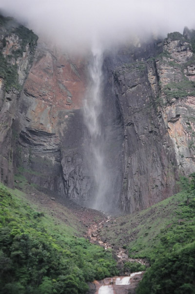
Location: Venezuela I asked how they measured the height of the falls, the guide said by lasers. |
 |
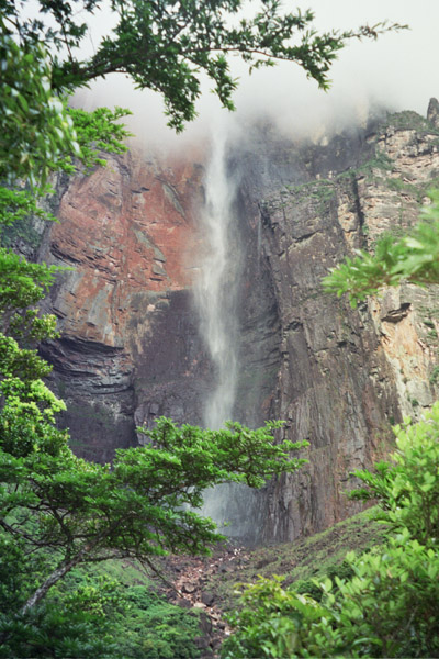
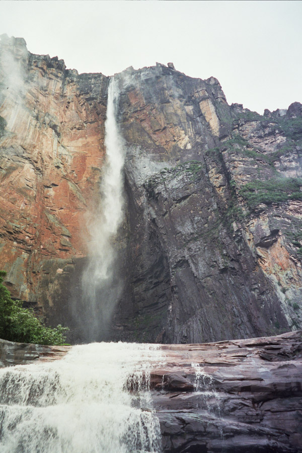
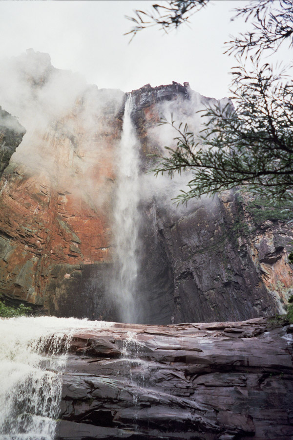
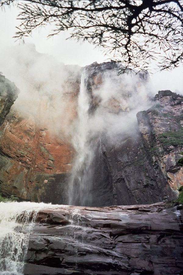
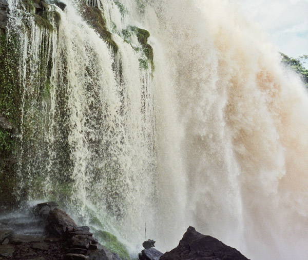
Angel Falls
Location: Venezuela It is extremely difficult to get good shots of the falls because it is often covered by clouds. |
 |
Angel Falls
Location: Venezuela The falls drains into/feeds a river |
 |
Angel Falls
Location: Venezuela Another rare cloud-free view of the falls. I took several rolls of shots of the falls, and this is one of the best pictures I got. |
 |
Angel Falls
Location: Venezuela One last look at the falls. |
 |
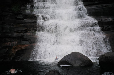
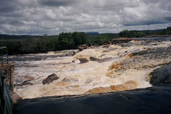
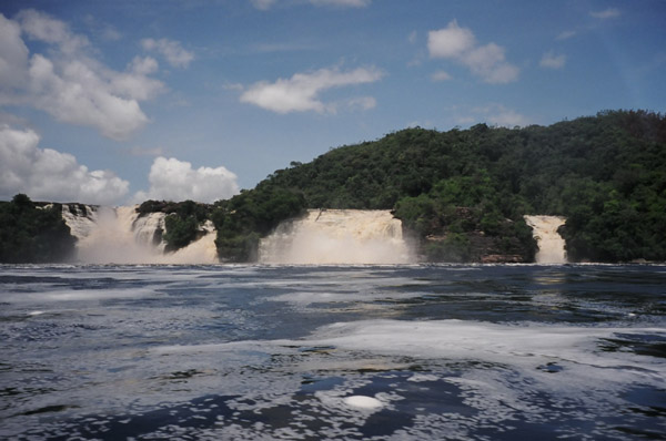
Hacha Falls
Location: Venezuela Hacha falls, very near Canaima Waku Lodge. |
 |
Hacha Falls
Location: Venezuela Hacha falls generates a phenomenal roar. |
 |
Hacha Falls
Location: Venezuela Far away view of Hacha Falls. |
 |
Hacha Falls
Location: Venezuela Hacha Falls |
 |
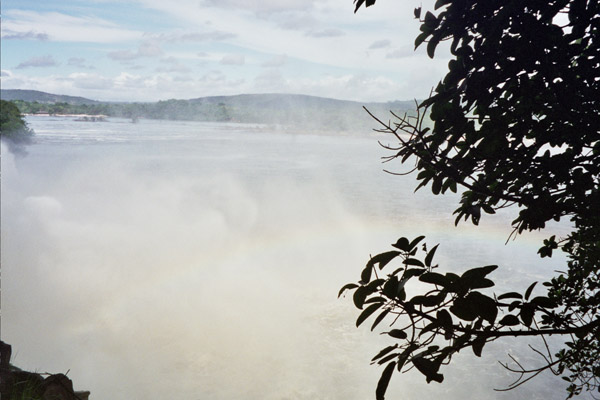
Hacha Falls
Location: Venezuela Rainbow generated from Hacha Falls |
 |
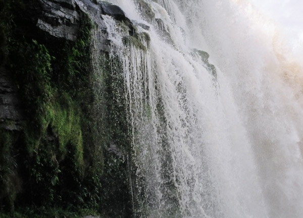
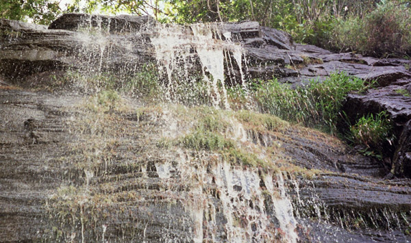
Hacha Falls
Location: Venezuela Water trickles from other places, make the ground slippery. |
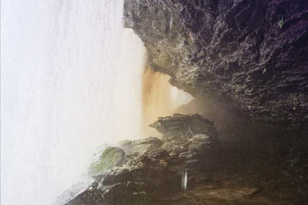 |
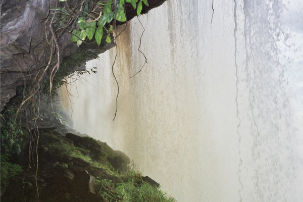
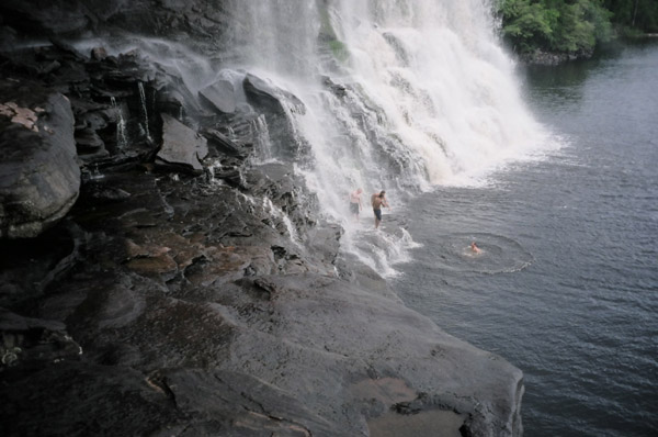
Hacha Falls
Location: Venezuela What makes Hacha falls interesting, is that you can walk behind the falls. |
 |
Hacha Falls
Location: Venezuela Another shot taken behind Hacha Falls after you have walked under it. |
 |
Hacha Falls
Location: Venezuela Hacha Falls is a short 20 minute hike from the camp site. |
 |
Sappo Falls
Location: Venezuela Sappo Falls just a short hike beyond Hacha Falls. |
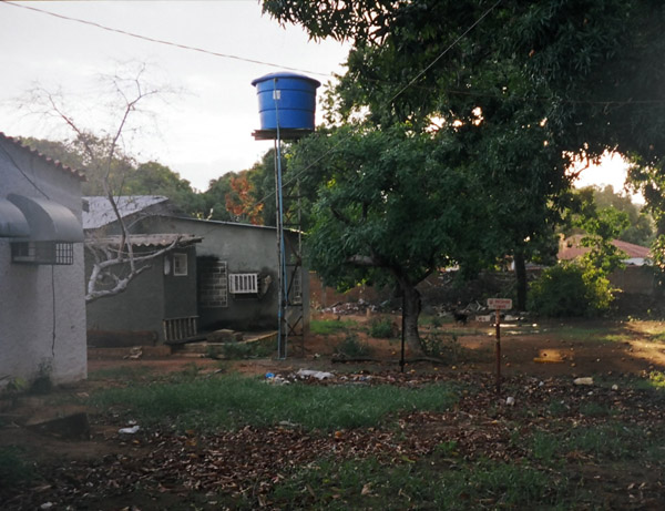 |
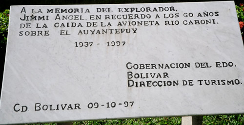
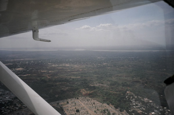
Ciudad Bolivar
Location: Venezuela A typical home in Ciudad Bolivar. Note the elevated water tank. The city is named after Simon Bolivar (b.1783-d.1830) He was known as "The Liberator", was to five South American nations what George Washington was to the United States. Bolivar was the catalyst that ended Spanish colonial rule in all of South America. Bolivar was born into Venezuelan nobility and was educated in Madrid. He spent time in England, France and the US, returning to Venezuela shortly before it declared its independence on July 5, 1811. He became an officer in the army of liberation and in 1813 he captured the capital city of Caracas. Made was dictator of Venezuela. He liberated New Grenada and merged it with Venezuela. He renamed it Columbia (after Christopher columbus) and on August 30, 1821, became president. Later, he defeated the Spanish in Ecuador and Peru. Upper Peru was renamed Bolivia in his honor. In 1826, he created a Bolivian constitution, naming himself president. In September 1826, Bolivar returned to Columbia, where he was reelected president. In November 1829, Venezuela seceeded from Columbia and Bolivar, and he was forced out of office and into retirement. |
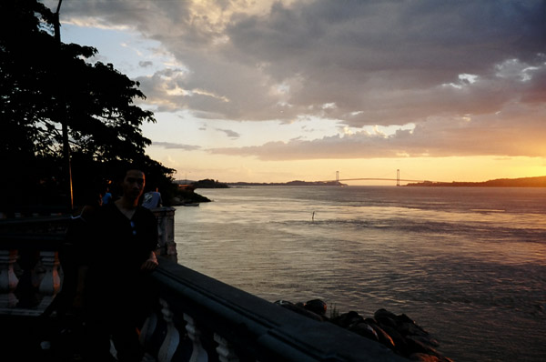 |
Ciudad Bolivar
Location: Venezuela Pictured in the distance is the longest bridge that spans the orinoco river. The Orinoco River is the world's 8th longest river at 1,290 miles long (2150 kilometers) It runs the length of the country. The Orinoco river system is the third largest system in the world, and originates along the borders of Venezuela and Brazil. The Orinoco river basin covers more than 1 million square kilometers. The name is derived from Guarauno words meaning "a place to paddle" (a navigable place). It flows west, then north and creates the border between Venezuela and Columbia. Then it turns east to bisect Venezuela. Large portions are still virtually inaccessible. The Guiana Highlands is composed of pre-cambrian rock up to 2.5 billion years old and some of the oldest on the continent. During the rainy season, the river reaches a width of 13 miles (22 km) and a depth of 330 feet (100 meters). 1000 miles of the Orinoco are navigable and 341 miles can be used for large ships. It begins on Delgado Chalbaud mountain. |